' Our First Time Heli-Hiking! '

We're planning on using the village of Fox Glacier as a base for a couple of days. It's located near the centre of this National Park and gives us good access to all the facilities. We hiked at the villages of Okarito and Franz Josef on our drive through.
WESTLAND / TAI POUTINI NATIONAL PARK
WALKS: Pakihi Walk & Douglas Walk/Peters Pool
So, based on that new information ... today, we walked to kiwi territory and a river.
We're still seeing lots of walkers/hikers/treckers/trampers/backpackers. It's not unusual on these paths/trails/tracks to pass someone every few minutes! ... we didn't see any kiwis, they're mostly nocturnal, but we did see ... a very tame New Zealand Robin (a Toutouwai), views of the Fox Glacier , the Waiho River, the Okarito Lagoon, another suspension bridge and Peters Pool.


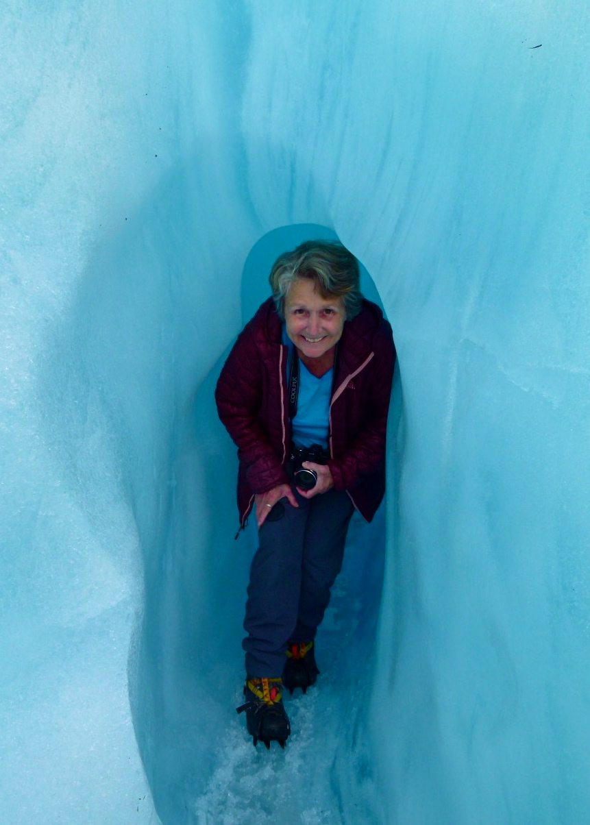
HELI-HIKING: Fox Glacier

Itinerary
A safety talk at Fox Glacier Guidings' base, a short bus trip to the heliport, fitted for hiking boots, another safety talk and then a short helicopter flight up the Fox Valley to the glacier. There we met Jude, our guide for the day, we were outfitted with crampons, given another safety briefing and then we were finally off on a hike. We've been up quite close to several glaciers before (in Alberta, BC, Yukon & Alaska) and we have also walked on a couple (Walker, Worthington), but this is the FIRST time we have flown to one.
Guides and pilots, told us that we were very fortunate to have one of the best weather days that they have seen in months.
The Fox Glacier Township has up to 5 metres of rainfall per year with up to 11 metres (YES!, I said metres) on the lower glacier and up to 15 metres on the upper icefall. Cloud cover and lack of visibility frequently force helicopter pilots to cancel flights. (Source: NZ Weather)
The Fox Glacier Township has up to 5 metres of rainfall per year with up to 11 metres (YES!, I said metres) on the lower glacier and up to 15 metres on the upper icefall. Cloud cover and lack of visibility frequently force helicopter pilots to cancel flights. (Source: NZ Weather)

' How many times is this now, that Helen gets to sit in the co-pilots seat on our low altitude flights? '
' We took too many photos as usual, but I felt that many of these landscapes were just too beautiful to not include. '
Note to an old friend: ' Rick if you're reading this it would have been great with you as the pilot. '


 ~
~
Follow us by opening TRAVEL MAP 2016/2017 on the right sidebar ([view larger], zoom +/-, pan around).
Click on any photo (some stock) in this post to launch a slideshow gallery of all the photos.
Wikipedia provides some content.
Crusty & Wry ... New Zealanders are justifiably proud of their Glaciers, this was a very special place!

No comments:
Post a Comment
Your comments, suggestions, observations and even opinions are welcome ... please leave some!