Northwest ICELAND
Part 4/4
Akureyri>Laugarbakki Village>Budir>Borgarnes>Reykjavik
Tunnels - Waterfalls - Lava Fields - Ravines - Shipwrecks - Canyons
________________
More Fun Facts
Iceland is considered an Arctic country, however only a small portion of it is actually north of the Arctic Circle; just the Island of Grimsey at latitude 66.55334. The furthest north we drove to was near Manartakki, (a couple of days ago) at latitude 66.20449. Just 0.3 degrees south of the Arctic Circle or as a distance ... approximately 35 kilometres. So, my personal goal of driving across the Arctic Circle in all Arctic countries won't happen ... drat; I'll have to settle for just visiting them all I suppose.
I imagine winter driving can be quite treacherous in the more remote parts of Iceland. Many farms seemed to have both a high-hoe (to dig a hole or maybe, dig a vehicle out) and an Arctic Truck 'build' (or the equivalent) parked in the driveway. We passed one large, expensive estate along the north coast and the landowner had a snow cat at the ready.
Iceland probably has the tastiest drinking water you will find anywhere! It's available everywhere here, you can drink as much as you want and ... it's FREE!
_____
Route
_____ This Post
_____ Previous Posts
________
JOURNAL
I've used the Iceland font for Icelandic placenames where we stayed on our driving route or as sidetrips we took and for some Journal details.
My sincere apologies to any native Icelanders for any spelling errors I may have made.
____________________
How to View This Post
Normal: View photos and scroll by any text that doesn't interest you.
Quick: Two options that will skip all the text.
1. Single click on any photo in the post. That will launch a gallery of all photos for the post displayed along a horizontal bar at the bottom of your browser. Then, just scroll through using the arrow keys (< >).
2. See * below.
Long / Very Long: Depending on your level of curiosity, additional information and detail is available by clicking on any of the blue links; most often the source for content that is not ours.
________________
Photography
Cameras: NIKON Coolpix P610 & CANON DSLR EOS Rebel T8i
* For all photos from the 4 posts that were published for this trip, see our Trip158 gallery. Viewing our photography this way, has the advantage of displaying the photos as full screen on your monitor. But, just so you know ... there are several hundred.
____________________
______
Day14
Route: Akureyri > Laugarbakki Village
Sidetrip: > none
Distance (Daily / Cummulative): 285.3 / 2261.0 kms
Hiking (Daily / Total): 2 / 93.4 kms
Camp09: 1 night @ Hotel Laugarbakki
A bright, sunny🌞and clear morning ... still fortunate with the weather; this is our day 14 and we've only had 2 days with mild drizzle and some overnight heavier rain.
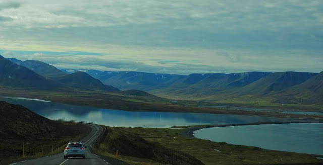
Four tunnels today, 2 single lane and one of the double lane tunnels was 7 km long; a new record for us. Mostly a driving day along the coast, no hikes just some short walks. We're following the 'primary' Eyjafjordur, Skagafjordur and Hunafjordur fjords and heading westerly.
 |
The dual Hedinsfjorour Tunnels, with a total length of 11 km, were dug between Siglufjordur and Olafsfjordur to connect with the region of Eyjafjordur in the east, and opened on 2 October 2010. Siglufjordur was already connected by the 800 m tunnel Strakagong to the west; it used to be the town's only road connection open year-round. That tunnel was completed in 1967.
|
 |
Siglufjorour
Look closely and you'll see the avalanche fencing (photos above and below) across the high mountain slopes above the village. This is the northernmost village that you can drive to in Iceland. To get here you can bypass the tunnels and still follow the old mountain road (only in the summer months) ... it's the highest road in Iceland. We took the tunnels ... 😀
|




______ Day15 Route: Laugarbakki Village >Budir Sidetrip: > Stykkisholmsbaer Distance (Daily / Cummulative): 268.1 / 2529.1 kms Hiking (Daily / Total): 1 / 94.4 kms Camp10: 2 nights @ Hotel Budir
It was a very rainy day; drizzle with periodic heavy rain and a lot of fog higher in the mountains. The drive also passed through an area of new highway construction, so much of the road surface was gravel. Fortunately, the weather cleared somewhat and enough times, for us to take a few pictures along coastal Highway 54 ... we decided it has the most dramatic scenery of the 2529 kms we've driven, so far in Iceland ... the vibrant Autumn colours probably helped us reach that conclusion.
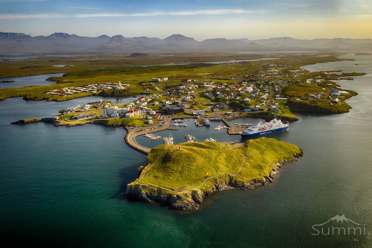
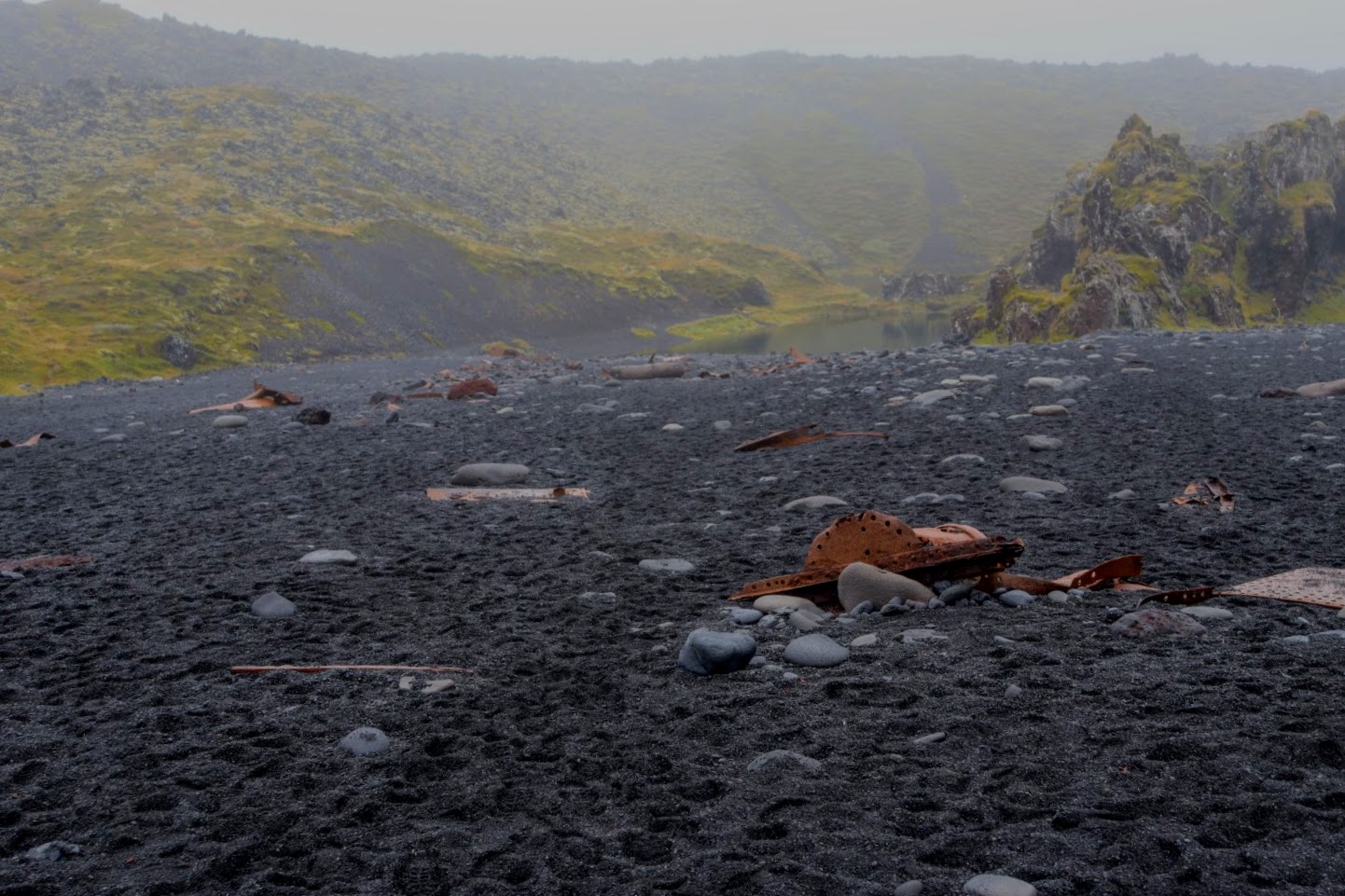
Shipwreck in the foreground and the fishing village of Stykkisholm in the background. There are nearly 2700 islands in the bay north of the village.
That's a lava field you're looking at.
______ Day16 Route: @ Budir Sidetrip: Budir > Olafsvik Distance (Daily / Cummulative): 135.6 / 2664.7 kms Hiking (Daily / Total): 7.41 / 101.8 kms Camp10: 2 nights @ Hotel Budir
Rain overnight, early morning low fog, drizzle, cleared before noon, fogged in again by mid-afternoon, heavy rain around 4 pm, high 13 C. Gewme (that's how he pronounced it) at the National Park visitor centre, told us this is the nicest September he can recall. Even though it rained today, this really is only the 2nd half day (in 16) we've been 'rained out'.
On the south coast of Iceland’s Snæfellsnes peninsula, there’s a village with only a hotel and a tiny black church called the Búðakirkja. It was erected in 1703 by Bent Lárusson, who was a merchant in Búðir. It rotted down but was rebuilt by Steinunn Sveinsdóttir in 1848. Legend has it that she did this following a request by Bent Lárusson in a dream.
Friends
Rauðfeldsgjá is a deep, high and narrow ravine in the cliffs south of the glacier Snæfellsjökull with a dramatic story and family tragedy attached to its name. The location is near the tiny hamlet of Arnarstapi. Seen from the road, it looks like a small crack in the berg that slid just a bit, enough for people to enter and observe. If you look closely, you can see 2 hikers just at the entrance.
Bárður was according to Bárðar Saga Snæfellsáss the settler of this area, half a troll, and half a man, his father was half a titan, but his mother was human. Bárður came to Iceland in the 9th century and gave the peninsula its name, Snjófellsnes peninsula, but both words "snær" and "snjór" mean snow in Icelandic.
Note: Remainder of the photos in this post are taken in the NP.
______ Day17 Route: Budir > Borgarnes Sidetrips: > Gianni & Hraunfossar Waterfalls Distance (Daily / Cummulative): 242.7 / 2907.4 kms Hiking (Daily / Total): 4.7 / 106.5 kms Camp11: 1 night @ B59 Hotel
Some overnight rain, early morning drizzle, some low fog; then it cleared for several hours in the afternoon ... by 6 pm the drizzle moved back in. Just a couple of easy walks today. We only have a short drive to our final (on the road) nights stay at Borgarnes today; then it's back to the capital; Rekjavik for a couple of additional days, before flying home to Canada ... this adventure is winding down.
... just another beautiful canyon!
Last Lupins of the season.
The locals believe it to be the dwelling place for elves and trolls.
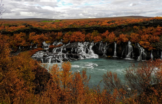
The lava field that Hraunfossar trickles through flowed from an eruption of one of the volcanoes lying under the nearby glacier of Langjökull, the second largest ice-cap in Iceland. The waterfalls pour into the Hvítá river from ledges of less porous rock in the lava; that seemingly originate in a field without a river or a lake. The water is actually streaming through rivulets in the Hallmundarhraun lava field.


______ Day18 Route: Borgarnes > Reykjavik Sidetrips: None Distance (Daily / Cummulative): 160.7 / 3068.1 kms Hiking (Daily / Total): 2.0 / 108.5 kms Camp12: 3 nights @ Iceland Air Hotel
Mostly a clear day, high 15 C. The highlight of our final driving day was the trip along the inside coastline of the scenic Hvalfjordur fjord.
This cairn holds an emergency food cache. Carefully piled rocks formed into a cairn make a landmark. In centuries gone by, cairns could mean the difference between life and death in the less hospitable parts of Iceland. They would break up long journeys on foot and reassure the weary traveller that they were indeed on their way to their friend’s farm or the next village, and not over the edge of a hidden cliff, or into the mouth of a volcano. Important stuff, right?
Iceland’s cairns are carefully catalogued and are protected structures. Some of them are hundreds of years old, and one is even believed to be the oldest structure in the country—literally built by one of the Viking settlers.
Unfortunately, in recent years, modern-day visitors have started building a lot of cairns of their own. ... All. Over. The. Place. Much like the proliferation of countless Inukshucks in Canada's north (and south); this cultural appropriation by uninformed people only has the effect of making both of these symbols irrelevant. Personally, I knock Inukshuks down and scatter the stones; when I find them in places they shouldn't be.


 |
___________ Days 19 > 21 Route: Around Reykjavik Distance (Daily / Cummulative): 0.0 / 3068.1 kms Hiking (Daily / Total): 7.5 + 5.3 / 121.3 kms Camp13: 3 nights @ Icelandair Hotel Marina
We had mixed weather over our time here; some drizzle and rain, some clear and sunny skies ... typical for this time of year. Walked the main shopping district of Rekyjavik, visited the National Museum of Iceland. Rekyavik Scenes ... pedestrian malls mixed with some vehicle traffic, local youth on scooterboards, more building art and graffiti than other parts of the country, some streets are fairly steep, lots of bars and restaurants, a lunch at the Old Iceland Restaurant
A few photos taken at the National Museum of Iceland ... certainly worth a visit. Lunch at the Old Iceland Restaurant ... appetizer of cured salmon, trout roe, pickled cucumber, dill mayo, rye crumble ! _____ About Food
We've had some fabulous 'eats' in Iceland.
We haven't prepared any food on this trip; all our meals have been in restaurants and often at the hotels where we were staying. We've eaten in roadside cafes, roadhouses, pizza joints and higher end eateries and restaurants. We've had very few disappointing meals. Icelanders really know how to prepare and serve up breads, soups, butter, skyr, arctic char, salmon, trout, lamb. Matorka Farms in particular, is worth mentioning here because of their environmentally friendly and innovative programn for farm raised Arctic Char.
There seems to be a short supply of fruits in some regions; we were offered very few berries and limited citrus, mostly just a couple of different melon varieties and bananas. I had one of the best takes ever on a 'caprese salad' here in Rekyjavik. A variety of cheeses is also not often offered; however the burrata cheese used in a number of traditional Icelandic dishes is certainly worth trying if you can find it offered on a menu.
_______________
If You Come to ICELAND
We want to extend our appreciation to the Nordic Visitor travel service and in particular to Margrét, who was extremely helpful and very quickly answered any questions we had.
Right up front ... the only negative we found, was that ... everything is very expensive here. Other than that, you will meet friendly and helpful Icelanders, experience some of the most rugged and scenic landscape on the planet, all in an environmentally conscious and very clean country.
We were here for 3 weeks in September; a time of year when the country can experience a lot of rainfall; however we didn't have much and the little we did, didn't affect our daily travel plans. The temperature ranged from just above 0 - 15 C and the winds were only ever as strong as moderate.
We didn't find it that difficult navigating our way along the various driving routes. Our rental vehicle was supplied with unlimited WIFI and I would suspect other rental companies offer the same option to tourists. Detailed area map boards are usually available at road intersections, signage is large and colourful, speed limits are clearly posted.
As in most European countries, tipping is not required in ICELAND, but you can tip if you want. Workers in service and restaurant industries are paid according to sectoral wage agreements which are supposed to guarantee a minimum living wage. At restaurants and bars the wages of the servants, baristas and bartenders are all included in the price. The same applies to taxis and all guided tours.
'Carving on a Sperm Whale tooth'
|
|
____
Next
Flight from Reykjavik ICELAND > Toronto CANADA
Regroup and repack for some LOAFin Around in October ...
Then, 5 weeks swimming with the fishes in Cozumel MEXICO ... December 2022 to January 2023.
_________________________________________________________________________
We're Kanoe Tripping with a Mitsibushi Eclipse Crossover Hybrid this adventure
... LOAF stayed at BASECAMP.
You can follow all our travels from here.
For all photos from this trip see our Trip158 gallery.
________________________________________________________________________