|
| Stock Photo |
______________________________________________
Viewing
If you're a curious individual, click on these links for additional information. If you're not, then ... double click on any photo to bring up a scrollable gallery of all photos in this post and eliminate all text. Or, simply scroll through without doing either.
______________________________________________
Agawa Bay Campground
At Agawa Rock, near the mouth of the Agawa River, there are pictographs created by the early Ojibwe people of this region. The figures are painted on the rock with a mixture of powdered hematite and animal fats and are estimated to be 150–400 years old. The records are visual representations of both historical events and legendary figures. Selwyn Dewdney was the first scholarly figure to discover the pictographs. The first written description of these pictographs was published in 1851 by American ethnologist, Henry Rowe Schoolcraft. As United States Indian agent in Sault Ste. Marie, he conducted extensive studies about the Ojibwe people, aided by his wife Jane Johnston Schoolcraft, who was half-Ojibwe and the daughter of a major fur trader in the city. (Source: Wikipedia)
____________
The Coastal Trail
We had a couple of free hours before our campsite was available. We took advantage and hiked a short, nearby section of the coastal backpacking trail.


 |
The crystal, clear waters of Lake Superior. |
 |
Black Bear nearby ... |
If you like rocks ... AND, if you like to take pictures of rocks ... then the Lake Superior coastline is a great place for wandering and shooting!
Camp One ... 2 nights
 |
We both decided that after 31 years of TC travel; this is our first ever sand beach campsite. (Camera: Iphone 10) |
 |
Sunset views from LOAF's dinette window. |

Camp Two ... 4 nights
We're fortunate to have been able to book 6 nights (2 different sites) at the Agawa Bay Campground. All are beachfront sites in the tenting area - we're able to drycamp, it's quieter and more private. We've had a mix of weather on this trip so far; sunny, overcast or rain but always warm. After speaking with the Park Warden; apparently our weather here has been somewhat unusual for this time of year. Last year around the same date ... a major storm front moved in and the 'rollers' coming off the lake were so intense it forced all the tenters to abandon their sites and relocate to higher ground and further back in the campground.
 |
Contemplation |
 |
"Paddling irons the wrinkles from your soul" Anonymous |
__________
Nokomis Trail
Difficulty: 5.0 km loop (Moderate to Difficult)
We walked the trail in a counter-clockwise direction and were glad we did. The 'up' section that begins here was long and steep and the rocky sections difficult to negotiate; however a 'down' would have been much more difficult on the knees had the trail been walked clockwise.
Description: As you follow the trail through the Old Woman River Valley, note the mysterious Pukaskwa Pits found along the way. These man-made depressions are believed to be 2000 years old. A vigorous upward climb brings you to the first lookout. It offers an excellent view of the river valley and forests below. Travelling north along a granite ridge, you will hike to spectacular lookouts over Lake Superior. To the west is the Old Woman Bay cliff, rising 200 metres above Lake Superior. Look for the face of an old woman 'Nokomis', immortalized in the rock. The trail descends past a series of intermediate lookouts and enters a stand of red pine, stunted by the lack of soil and nutrients in the rocky area. (Source: MNR Ontario)
 |
Old Woman River Valley |
 |
Several 100 feet through initial sections of the trail are covered with medium sized river rock. |
 |
This first lookout is the reward for that looong, steeep climb.
|
 |
Caves |
 |
Old Woman Bay cliff (on the left) |
_____________________
South Old Woman River Trail
Difficulty: 2.5 km loop (Moderate)
We only walked a short initial section of the trail; maybe 1/2 km return. The trail crosses the river over a fairly difficult rocky section; with slippery rocks, some necessary wading. Helen broke a wrist hiking last year around the same time; we weren't willing to risk another injury. This crossing would certainly be doable; given dry rocks, a hiking stick and good footwear.
Description: Short and scenic, the trail follows along it's namesake. The river is actually the site of a glacial spillway running northeasterly and eventually flowing into Lake Superior. Much of the trail is shaded by the forest canopy. Cedar trees favour the river banks where running water can saturate their root systems. A wide variety of ferns and moisture loving plants grow on the cool damp forest floor. (Source: MNR Ontario)
Trapper's Trail
Difficulty: 1.5 km loop (Easy)
Description: The trail follows the shoreline of Rustle Lake. The area supports a variety of wildlife such as: beaver, otter, marten, heron and moose. Originally, Rustle Lake was nothing more than a wide portion of a forest stream. Beavers then damned it and aquatic life grew into the shallow waters, forming a wetland. The abundance of fur-bearing animals resulted in the establishment of a trapline - licensed to the Renner brothers in the 1930's and active until the mid-1970's. Trapper's Trail is only a small portion of their former trapline which extended along the Baldhead River to Lake Superior. (Source: MNR Ontario)
 |
A mushroom community. |
 |
Isn't Nature amazing! ... the tricky fungus at top right has obviously disguised itself as a Fox turd to discourage squirrels and chipmunks from eating it. |
 |
Tendrils |
 |
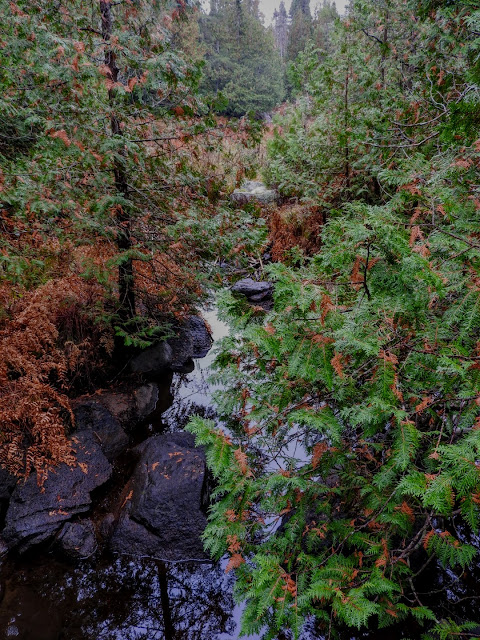
Luv wetlands ...
___________ Pinguisibi Trail
Difficulty: 6.0 km return, linear trail (Easy to Moderate) Travelling upstream, a hiker will pass five significant rapids (some ledges and falls) with numerous rock gardens between. Steep trail sections are short and moderate only; with the exception of a medium length steep 'down' at about the 2 km location along the trail. Short steep sections are usually followed by long, fairly flat trail portions. This hike is one of the prettiest in the Park.
Description: Pinguisibi is the name for 'river of fine white sand'. This river was an ancient route of travel used by the Ojibwa as they hunted, fished and trapped northwards into the interior. Following the trail along the north bank of the and River, you will pass a series of waterfalls interspersed with rapids. (Source MNR Ontario) |
 |
I see a sneak route ... |
_________________
Refer to our Trips153/154 gallery for all the photography ... from 2021's summer and autumn of 'covid interrupted' road tripping adventures.
Camera: Nikon Coolpix P610
Unless noted, all content is by LOAFin Around.
TEAM: LOAF, Crumby, Wry and Crusty
__________________________________________________________