
Showing posts with label Hiking. Show all posts
Showing posts with label Hiking. Show all posts
3 Oct 2026


12 Oct 2025
BACKYARD: Presqu'ile ... Farran ... Sandbanks
Or, if you prefer ...
"A Small Selection of Autumn Camping Sites for Anti-Social Old Grumps Like Us"
_________________________
Presqu'ile Provincial Park
This is a wonderful park ... for easy walks, hikes and bikes. At this time of year it's much quieter, 'car-camping' becomes more appealing, there are fewer people, many visitors are birders or naturalists, all the local critters are preparing or gathering for winter.
Not all sites would suit our camping style; regardless of the season. However, we scored a very private campsite with decent solar exposure, in the forested, un-serviced area and because we're in a 'dry' camping area; didn't have a single, nearby neighbour our complete stay.
___________________________
Some of our photography while here ...


It takes years to build character ...


Sphynx Moth

Merlin

____________________________
Farran Park Campground
We stayed here ... in September, on our way to the east coast. We consider this to be, a premium site; it's unserviced, partly shaded with full solar exposure if needed, large, private (only 1 neighbour), and well away from the main campground. No neighbours our last or this stay!!
Bonus! ... our oldest friend dropped by for dinner on our second day.


The wild asters were blooming in the large open fields to either side of our site.
_______________________________
Campfire rebuild and a Dutch oven dinner ...

Original: This was the condition of the firepit when we first camped here in September.

Rebuild 1: I dug it out and cleaned out all the old garbage and scattered the cold, wet ash into the surrounding bush. I added a lot of new rock and exposed the front for easier wood loading for cooking; our primary use for wood fire.

Rebuild 2: We use a woodfire primarily for cooking; burning wood for bonfire heat is not something we do unless necessary.

Air vent

Show rocks, flat stones for irons and grill.

I added even more rock from the nearby shoreline, added an air vent opening and some large show rocks at the water side, a couple of large, flat stones near the wall ends to support cooking irons and a grill, formed a secondary cooking area (primarily for dutch oven cooking) on the right side with flat stones near the ground and a rock post with pedestal. I also felt this rebuild deserved one of our 'CTCO Refurbished Campfire' signs. 😁

Two old firends telling lies.


10" dia. aluminum Dutch oven (placed on trivet), 5 briquets on the bottom, 15 on the top, cover with asbestos hood, bake for 45 minutes.


_______________________________
.
.
.


Met Jackie & Dan, a couple of Journeymakers; on our last day here. We leant our battery booster and brewed a couple of cups of coffee; they passed along some freshly caught bass and a recipe ... what could be better?


___________
Lost Villages
The Lost Villages of Mille Roches, Moulinette, Wales, Dickinson’s Landing, Farran’s Point, and Aultsville; the hamlets of Maple Grove, Santa Cruz and Woodlands; and the farming community of Sheik’s/Sheek’s Island, were not lost through carelessness, they were disposed of with Government approval “for the common good”. Over 6500 people were displaced in the name of progress for the sake of the St. Lawrence Seaway and International Hydro Electric project. Casualties of progress, the villages and hamlets disappeared beneath the waters of the newly created Lake St. Lawrence, but they stayed alive in the memories of their former residents.
A nearby museum ... unfortunately, when we visited; seasonal staff had left and the buildings were not open. Nevertheless, here are are a few photos of our walk-about ... we'll just have to return.


The Corn Crib, built circa 1860, was not from one of the lost villages. It was originally on the J. Fulton farm, Lot 37, Concession 5, Township of Cornwall, which was just north of Moulinette. It is typical of corn cribs of the period and is constructed from sawn planks over a frame of hewn and rough timber. It has a steep-pitched roof and slanted sides, which allowed the rain to run off away from the building, keeping the corn dry. The original cedar roof was replaced with a tin roof many years ago. There are vertical ventilation openings on the side walls to allow air to circulate in order to dry the corn. Corn cribs in the past would have been placed on stilts to ventilate the building. The stilts would have been covered in tin or a tin plate and would have been attached to the top, preventing mice from entering and eating the farmer’s crop.


Peeking in ...

____________________________
Sandbanks Provincial Park
Our first stay here ... we've lived nearby for nearly 8 years and it's less than a 25 km drive ! We're on site 319 in Cedar Campground; it's rated as average privacy. We only have one neighbour visble to us, the area is quiet at this time of year, the rear of our site is bermed and provides some noise protection from a nearby secondary road. We also have a short trail adjacent to the site which crosses over to the dunes and beach. The site was relatively tidy when we arrived; I cleaned the firepit of excess ash and raked the area around, picked up a minimal amount of burnable debris, found 1 fork & 1 spoon to add to our utensils tray and added some unburnt wood left by the previous campers to our stockpile for the next couple of days. Solar exposure is decent and the site is level.


The END
_____________________________


Not US, but could be one day soon.😁
We're LOAFin Around ... follow along if you'd like; content is ours, unless noted.
Click on Trip 170 for all photography for this trip.
Cameras: 1. iPhone 16 Pro Max
2. Nikon DSLR P1000
_____________________________
14 Sept 2023
EXCURSION: NEW BRUNSWICK: Miscou Island, Kouchibouguac NP - "Running from Hurricane Lee"
____________________
Our first post for this adventure ('A Road Trip Around QUEBECs' Beautiful GASPE PENINSULA'), documented travel for CAMPs 01 to 12. We're into the province of New Brunswick now; major stops at - Miscou Island and Kouchibouguac National Park. We had anticipated a much longer stay at Kouchibouguac NP and then a trip to Fundy NP; also for a lengthy stay.
Hurricane Lee changed all that ... we're on the run!
If you prefer to see our complete photo gallery without reading our blog from this adventure, then go here or come back to the link later.
And, as always, if you're interested in additional information or detail; click on any of the blue links we've provided.
________________
OUR ROUTE
___ Campbellton New Brunswick > Saint-Michel Quebec
8 days / 932.5 kilometres

_____________
JOURNAL
CAMPs 13 - 15
A BIG Bog & A Lighthouse
Route: Campbellton NB > Camping la Vague, Miscou NB
Distance (cumulative / daily): 2007.3 + 250.3 + 53.6 = 2111.2 kms
We drove to the ends of all the roads (there aren't many) on Miscou Island; certainly not a difficult task - the island is only 18 kms long x 7 kms wide. Walked some of the Grande Plaine (the BIG bog) and visited the Miscou Island Lighthouse National Historic Site. We did get rained out near the end of our stay here.
 |
SUN going down ... |

 |
Fishing for Atlantic salmon, sea (striper/striped) bass and (apparently) bluefin tuna. This fellow fished most of the time we were here and was also successful at foraging for wild mushrooms. He and his wife went for a long bath, swim and snorkel one day at the same spot ... I would have died! |
___________
Out and About

 |
| Shippigan Harbour |
_________________
LA GRANDE PLAINE
 |
 Cover as much skin as possible, use copious amounts of bug spray, walk faster than your hiking partner (notice how I'm out front); run if you need to, pray for a strong breeze ... other than that it's a great walk! |

 |
There are 8 bogs on Miscou Island, all in their natural state and covering an area of 3,225 hectares (almost 8000 acres), which is almost 45% of the surface of the island. |
 |
| Pitcher Plant |

 |
| Bohemian Waxwing |
 |
| Stock Photo |
If you visit in mid (to late) October these will be the colours you'll see.
__________________________
MISCOU ISLAND LIGHTHOUSE
 | |
"The heritage value of Miscou Island Lighthouse lies in its critical and longstanding role as a lighthouse as embodied by the tower’s function, setting, and composition. In 1856, the lighthouse was constructed by the Province of New Brunswick to reduce the number of shipping accidents in the region. Subsequently, it became a major coastal aid, providing safe navigation for ships entering the Chaleur Bay and for coastal traffic between the Atlantic Provinces and Quebec." (Parks Canada) |

Next 3 photos are taken from an 80 foot elevation on the top deck of the lighthouse.
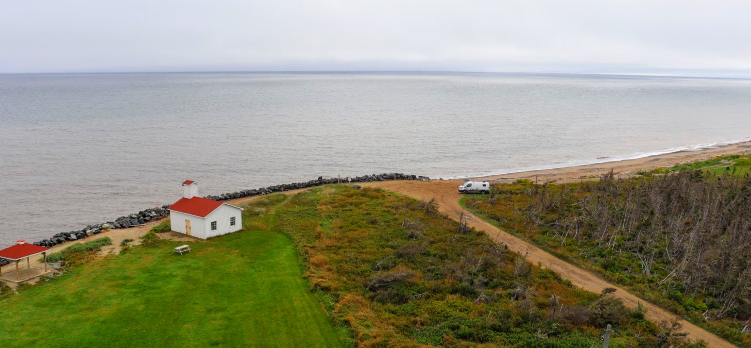 |
| Looking easterly ... good boondocking site! There are some very good opportunities for dry camping / boondocking near the Miscou Island Lighthouse and north along the shoreline from there. We always search out camping spots that offer activity based opportunities for us; walking, hiking, biking, paddling. These sites here at Miscou Island satisfy our particular criteria; there's privacy, beach walking, paddling opportunities, fishing ... and, you can safely have a campfire! Additionally, and in the case of this particular location, (a National Historical Site of Canada) ... if you do camp, visit here and pay the entrance fee to the site ($6/senior), you contribute to the upkeep and maintenance of one of Canada's important historical locations ... and that's a good thing ... EH! |
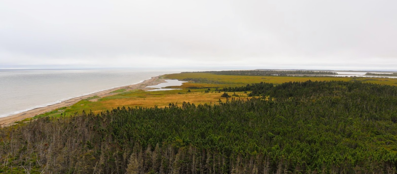 |
| Looking more easterly ... |
 |
| Looking north-westerly ... |

__________
Beach Walking
I suspect there aren't many parts of the shoreline of Miscou Island where you cannot walk. This walk was in front of our campsite and we could still see forever in both directions when we ended and turned back.


CAMPs 16 - 18
A Short Stay this Trip
Route: Miscou Island NB > Site #306, South Kouchibouguac Campground, Kouchibouguac National Park NB
Distance (cumulative / daily): 2111.2 + 212.1 + 16.8 = 2340.1 kms
We kept close to the coast and followed highway 11 most of the way today. At camp around 4pm, emptied and filled all tanks (black, grey, fresh, gas), lunch out, groceries.
Heavy rain here but we were able to get in a few short walks thru the dunes (Barrier Islands) on our last day. We spent 9 days in Kouchibouguac NP in 2019 and we were able to hike all (but one) of the trails and cycle most of the paths; this is a wonderful park for both those activities. Fortunately for us; we've only booked 3 nights this time ... because! ... BIG storm coming our way! So, we're going to change plans and head inland instead of towards Fundy NP; that'll keep us out of the predicted path of hurricane Lee over the next few days.
______________________________
KOUCHIBOUGUAC NATIONAL PARK


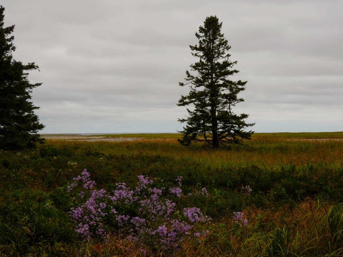


 |
What nice folks! We bumped into Conny and Simon a couple of times travelling around New Brunswick and finally got together for a campfire, snacks, drinks and of course ... an exchange of information regarding each of our countries. A Swiss couple, this is their 15th trip to Canada and they expect to return again in a couple of years. This time they arrived in May and will be returning their Class B Van in Halifax at the end of September and returning to Switzerland. I have a feeling we may see each other again. |
CAMP 19
Escaping and Hiding from Hurricane LEE ... Today!
Route: Kouchibouguac NP NB > (backtracking northwest to) Miramichi > (west to) Grey Rock Casino, Edmunston NB
Distance (cumulative / daily): 2340.1 + 328.6 = 2668.7 kms
Fuel Economy: 19l/100kms; extremely rough (and sometimes slow, 40kms) drive along hwy 108, some mild grade, very little wind.
Change of Plan: "A tropical cyclone information statement has been issued across all three Maritime provinces and parts of Quebec, warning that the intense system is likely to bring heavy rain and wind in the days ahead.
Western Nova Scotia and southern New Brunswick stand to see the most wind while western New Brunswick northward into parts of the Bas-St-Laurent and Gaspesie regions of Quebec are at risk of the heaviest rainfall.
High waves and elevated water levels will be more widespread due to the large size of the storm – the most impacted areas likely covering much of the Atlantic coast of mainland Nova Scotia and the Fundy coast of New Brunswick.”
CAMP 20
Back to Quebec
Route: Edmunston NB > Camping Parc Saint-Michel, Saint-Michel-de-Bellechasse, QC
Distance (cumulative / daily): 2668.7 + 271.1 = 2939.8 kms
Fuel Economy: 21.7l/100kms; head wind early on, massive road construction project on hwy. 85, some long grade changes
_____________
Where To Next ? ... we're making our way to the Saguenay region of Quebec, another area where we have not spent much time.
_____________________________

We're LOAFin Around
... follow along, if you like.
Refer to our Trip161 gallery for all the photography.
Cameras: Nikon Coolpix P610
DSLR Canon EOS Rebel T8i
Unless noted, all content is by LOAFin Around.
_____________________________
Subscribe to:
Posts (Atom)