With Team FOUR DEGREES
_______________________
 |
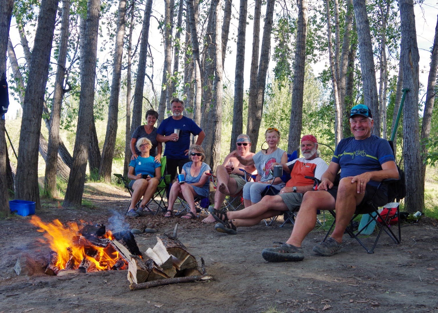
| The Final PADDLERS Briefing Clockwise: Katherine Boyd Peggy Tom Dann Helen DM Bryan (Photo: Waitress) |
Post Updated: August 11, 2019
Click on the links for additional detail
_________________________
Click on the links for additional detail
_________________________
ITINERARY
Up North will shuttle us from Whitehorse to our put-in at Johnson's Crossing.
From there we will paddle about 200 kms of the Teslin River to it's confluence with the Thirty-Mile / Yukon River at Hootalinqua. The current of the river from Johnson's Crossing is almost unnoticeable. After a few days the current will pick up and once the river confluences with the Thirty-Mile River, current will be obvious and welcome.
On a previous trip, some of this group paddled 604 kms on the Thirty-Mile and Yukon Rivers from Deep Creek on Lake Laberge to Dawson City. We will repeat a 160 km section of that trip, from Hootalinqua to our take-out at Carmacks. Up North will then collect us the following day and return us to Whitehorse.
RIVER DESCRIPTIONS
 |
The name YUKON is from the Gwich'in word Yu-kun-ah meaning "great river". The river’s source is in British Columbia, Canada. The lower half of the river lies in the U.S. state of Alaska. The Yukon is 3,190 kilometres (1,980 mi) long and empties into the Bering Sea at the Yukon–Kuskokwim Delta; 1149 kms are in Canada.
OBSERVATIONS
We had sunny, warm weather on every day except for rain in the evening and overnight on our final river day. Both rivers were quite shallow and meetings with the local Tutchone as we traveled along verified that water levels were historically low. The Teslin, even though less technical, is a more intimate river than the Yukon and our time on it was quite enjoyable. This is a good river for beginner canoeists and novice river trippers. We were surprised to find our takeout at Carmacks at least 4 feet lower than our 2012 trip . Grayling fishing was very good at the mouths of several small creek confluences.
MAP READING and COORDINATES
We traveled with 2 river guides.
" Teslin River - Johnson's Crossing to Carmacks " by Mike Rourke and Gillian Rourke
" Teslin River Guide " by Len Webster and Harris Cox.
Used together they provide the best overview of the rivers. The Rourke guide gives a more detailed historical account with well drawn river depictions. The Webster/Cox guide reflects group campsites (5 tents or more) only and refers to 1:50,000 and 1:75:000 Canadian NTS maps.
Caution: Both guides quote geographic locations in DMS (degrees, minutes, seconds) of latitude and longitude. Set your GPS instrument to this format. Important to note that neither guide quotes a coordinate source (vintage, systems, GPS accuracy etc) or equally important, a map datum (NAD27, NAD83, WGS84). Without knowing either, paddlers should be aware that GPS positions given, should not be relied on for anything other than an approximate location on the river.
And, for river trippers ... good map and river reading skills will always be the preferred method for determining where you need to be.
This should be a slow, easy trip ... 11 river days, Class I+

TESLIN RIVER
DAY 1
Put-In: It's about a 1 hour drive from Whitehorse to Johnson's Crossing
River Notes: Hot and sunny, slow paddle, one other boat
Wildlife: several bald eagles, cliff swallows
Daily / Cumulative Distance: 22 / 22 kms
Camp: HENRY ISLAND
 |
| The shuttle pickup by Up North |
 |
| The Put-In (Photo: Katherine) |
 |
| Discussing the Tobacco Ceremony ... giving thanks to the creator for safe passage down the river. (Photo: Katherine) |
 |
| (Photo: Katherine) |

 |
| The first paddle strokes ... (Photo: Katherine) |
 |
| (Photo: Katherine) |
 |
| (Photo: Katherine) |
 |
| Bald Eagle (Photo: Katherine) |
 |
| Bald Eagle (Juvenile) (Photo: Katherine) |
 |
| Cliff Swallows (Photo: Katherine) |
 | ||
(Photo: Katherine)
|

 |
| First dinner on the river ... ribs and corn. |


 |
| Natures refrigerator |

_____
DAY 2
Wildlife: More bald eagles, arctic terns, pacific /(or arctic?) loons. Note: The pacific loon’s most notable feature is its vibrant purple throat.
Camp: River Left across from 100 MILE LANDING, very good site. So named for its distance from Hootalinqua.
History: It is believed that it was a supply base for the isolated community of Livingstone, site of the turn of the century Livingstone Goldfields.
 |
| (Photo: Katherine) |
 |
| (Photo: Bryan) |
 |
| YUCHOO ... from the Loucheux Indian word meaning "greatest river".
The Yukon Territory is believed to be the first area in Canada to see the arrival of humans. Between 10000 to 25000 years ago, people from Asia crossed via a land bridge over the Bering Sea to Alaska and the Canadian Arctic. In the 8th century, traders from Russia are believed to have been the first Europeans to enter the area.
|
 |
| Happiness Hour |
 |
_____
DAY 3
River Notes: Current picked up today, riffles and boils, smoke in the air, horsetail clouds (signal a weather change in 24 hours)
Wildlife: eagles, terns, kingfishers, otter, porcupine, gulls, moose cow with calf at dusk
Daily / Cumulative Distance: 23 / 59.5 kms
Camp: MARY RIVER; good camp but difficult landing - small entry across boily water, good gray-ling fishing, difficult exit - ferry high upstream, move river right to gravel bar and past boils on river left. Caution: This was low water so I imagine that in higher water conditions this landing would be much more difficult.


 |
| The Wine Barrel |
 |
Daily map review and planning for tomorrow's camp. The Webster/Cox guide only marks campsites that are suitable for 5 boats or more, so is most useful for groups of canoeists. There are numerous spots that would accommodate fewer tents and in an emergency would work for larger groups like ours, but obviously would be much less private. We attempted to have easy-paced paddling days that still allowed us to reach camps and set-up no later than 3 - 4 pm, each day.
|
 |
| ... casting for Arctic Grayling. |

 |
| This group trip relied on a roster schedule to divide camp chores equally. Each couple was responsible for providing their own breakfasts, lunches and snacks and for some of the group dinners. Each day, one couple handled the water and fire duties, one cooked the evenings dinner and another managed cleanup. This allowed one couple to have a day off from chores every 4th day ... the Lazy Bums day. |
 |
| (Photo: Katherine) |
 |
| (Photo: Katherine) |
 |
| Moose Cow and Calf at dusk |
DAY 4
River Notes: Over 10 km/hr, boily, more smoke, 14 gray-ling caught, Gypsy Queen fish camp
Wildlife: a young deer crossed the river, 2 porcupine
Daily / Cumulative Distance: 38.8 / 98.3 kms
Camp: SHELDON CREEK

 |
| River Beauty (Photo: Katherine) |
 |
FISH CAMPS
There are a number of Fish Camps along the river. These reflect a semi-nomadic culture whose roots were influenced by migratory animals and climatic patterns. During spring, summer and fall, they would gather at fish camps along the rivers to harvest and smoke-dry mostly salmon, or hunt animals. In winter, they would settle near fish lakes and dry their food supplies. |
 |
| Cut Banks (Photo: Katherine) |

 |
| ... these two fishermen caught, cleaned and cooked up a mess of Arctic Grayling. |


DAY 5
River Notes: to Roaring Bull Rapids (Netadinlin); other than a “rush”, the rapids are not technical or dangerous. Current, standing waves, very boily, some CI, speed 10- 12 km /hr, islands and debris, gravel bars, very large burn area, couple of fish camps, it rained wildfire ash in the evening
Wildlife: many eagles, one group of 4 juveniles and 2 adults, gull
Daily / Cumulative Distance: 34.9 / 133.2 kms
Camp: O'BRIEN'S BAR, rusted remains of an old gold mining operation that ended in 1936
 |
| Our first views of the smoke from active wildfires in the area. |


 |
Remnants of the gold mining operation. Cabin remains, old barge, tailing piles, ditches, mining equipment, old motor, pumps, tumblers, sluice boxes.
|
 |
| Engine |
 |
| Pump parts |
 |
| Cable winch |
 |
Organizing the food barrels. Individually labelled plastic bags are used for breakfast ingredients (cereals, coffee, yogurt), drinks, breads (wraps, bagels), snacks (gorp, bars), lunches, all ingredients for daily dinners (D1 D2 etc), appetizers (crackers, cheeses, canned fishes), desserts (chocolates, fancy cheeses, cookies). Ingredients are often duplicated or end up being shared by bags once the barrels empty out. Ingredients to be used last are kept to the bottom of the barrels, light foods like bread products are kept on the top to keep them from being crushed. Fresh fruits and vegetables are often separated out and used to fill gaps between bags.
|
 |
| ... more planning |
_____
DAY 6
River Notes: smoke for 30 kms today - heavy and thick sometimes, periodic flame, 200 - 300 foot visibility, river narrow here with centre third blocked by smoke, navigation difficult at times, wore wet face bandannas, eyes stung, thunder-boomers in the evening.
The fire was reported here.
An extract ... the fire near the Teslin River, 69 kilometres northeast of Whitehorse, is burning in the wilderness and is approximately 1,600 hectares in size.
Wildlife: deer, eagles, beavers, kingfishers
Daily / Cumulative Distance: 48.5 / 181.7 kms
Camp: EUREKA LANDING (SEVENTEEN MILE), difficult to find, old trail covered in fallen trees, wood-cutters site, 5 cabins in various stages of disrepair, grave site behind cabin
 |
| Fly ash collected on the tents overnight (Photo: Katherine) |
 |
Some of us wore a wet face buff / bandana. The smoke was quite thick at times and we worried about breathing difficulties ... stinging eyes by days end. (Photo: Bryan)
|
 |
| (Photo: Bryan) |
 |
| (Photo: Bryan) |
 |
| (Photo: Bryan) |
 |
Several pieces of gear were supplied for this group (by D&H or rented (*)) ... a medium tarp (used once), small prep table, an exposure shelter (never used), * coleman stove, wannigan (incl. dromedary, water filter, cooking set, utensils kit, cleanup sac, repair kit, axe and saw), firebox. The group shared expenses for propane coleman fuel and some cooking accessories (tinfoil, oils and spices). In addition to these, most couples carried personal water filters and stoves and other items like (2) additional sinks, a spare saw and a pot were added to the wannigan.
|


YUKON RIVER
_____
DAY 7
River Notes: very easy day, some smoke, beautiful turquoise water at the confluence with the Thirty Mile River, good weather, more paddlers now
History: Hootalinqua Village
Wildlife: there's been a noticeable change in the food chain - no eagles or loons, deer flies and horseflies are out
Daily / Cumulative Distance: 21.5 / 203.2 kms
Camp: HOOTALINQUA VILLAGE

 |
| HOOTALINQUA
The word is Northern Tutchone for 'running against the river'. Popular gathering and trading centre for First Nations. Gold finds on the Teslin and Upper Yukon, along with its calm waters, led to it becoming and important supply point in the 1890's. NWMP, telegraph and a general store were located here in the early 1900's. It was also important as a winter docking yard during the era of steamboats.
|


 |
| An ancient 2-holer |
 |
| A pile of ... History |
_____
DAY 8
River Notes: 15 km / hr, smoke mostly gone, more paddlers, long burn area, still a boily and gravely river, confluence with the Big Salmon River
History: Shipyard Island /(Hootalinqua Island), Big Eddy Woodcamp, Klondike I
Wildlife: moose at shoreline
Daily / Cumulative Distance: 47.0 / 250.2 kms
Camp: BIG SALMON VILLAGE (GYO CHU DACHAK)
 |
This was a winter storage yard for sternwheelers. The British Yukon Navigation Company built it in 1913. It is the last example of this kind of facility on the river. The 360 ton S.S. Evelyn was hauled ashore here in the fall of 1913. Through the years it was used for spare parts.


 |
| KLONDIKE I
Not much remains. In 2012 the river was several feet higher ... when we paddled by it was mostly submerged. We found out later during a tour of the Klondike II, in Whitehorse, that the complete super-structure and all mechanical equipment from the Klondike I was used in the new vessel; only the wooden hull was left behind.
|

 |
| BIG EDDY WOODCAMP shore marker |
 |
| Old wooden wheel-barrow |
 |
| BIG SALMON VILLAGE buildings (Photo: Katherine) |


(Photo: Katherine)


 |
| Shoreline at BIG SALMON VILLAGE
Old native fishing site which became a steamboat stop. During goldrush it had NWMP, telegraph and a trading post. Continued to be used by natives for trapping and fishing, Commissioner Walsh spent the winter here in 1897 on his way to Dawson City posting. With few supplies he spent a rough winter. His experience resulted in his issuing the famous "ton of goods" order for all gold-rushers heading to Dawson.
|
DAY 9
River Notes: smoke gone early today, gravel islands and cobble bars, braided channels with low water, a minor drag over, moose hunters on the river
History: Alligator on shore
Wildlife: moose, loud cat-like (lynx?) screeches over night, more eagles
Daily / Cumulative Distance: 39.3 / 289.5 kms
Camp: TWIN CREEKS


(Photo: Katherine)

(Photo: Katherine)
 |
The Teslin is by no means a heavily braided river. However, given the historically very low water encountered, we were fortunate to only have this single incidence of a short gravel bar drag-over. (Photo: Katherine)
|
 |
Alligator remains above ...

... these boats were a type of amphibious vehicle used in the forestry industry throughout Ontario, Quebec, the Maritime provinces of Canada and the northern territories of Yukon and NWT from the mid-19th century to the beginning of the 20th century. These boats were so named because of their ability to travel between lakes by pulling themselves with a winch across land. Alligators served as a "warping tug". They towed log booms across lakes and then portaged themselves using a winch to the next body of water. The rugged, steam-powered tugs were one of the pioneers in the mechanization of the forest industry in North America. (stock photo)
|


DAY 10
River Notes: locals told us the river is very low, new gravel bars and islands, confluence with the Little Salmon River today, overcast, more smoke overnight, some light rain early evening, no paddlers today
History: visited Little Salmon Village
Wildlife: another lynx fight
Daily / Cumulative Distance: 50.9 / 340.4 kms, Note: longest paddling day distance this trip
Camp: MACAULEY BAR
 |
| LITTLE SALMON VILLAGE
Believed to be the longest, continuing native settlement on the river. Used during Salmon runs by the Little Salmon/Carmacks First Nations to fish and dry salmon.
|


 |
| SPIRIT HOUSES
Native peoples were originally cremated. Spirit houses were built as a home for the ashes and sometimes personal effects. Though natives began burying their dead in the second half of the 19th century these lodges are still built on top of the burial site. Spirit lodges are respected as the resting place of the dead. Note: These and other Yukon First Nation burial sites are sacred places that are now protected under land claims agreements.
|


 |
Gill nets. Locals told us that commercial fisheries in the Bering Sea have caused a dramatic decline in the number of salmon they are catching ... lucky if they get one or two a day.
|
 |
| EAGLE or EAGLES'S NEST BLUFF (TS'AL CHO AN) |


DAY 11
Take-Out: Carmacks
River Notes: landing here was 4-5 feet lower than 2012, docks at the campground now, river parallels the Robert Campbell Highway
Wildlife: eagles, beaver
Daily / Cumulative Distance: 19.6/ 360.0 kms
Camp: COAL MINE CAMPGROUND
 |
Meegwetch
Means "thank you" in First Nations language.
Each day, one of us would collect items and arrange them on the ground. In this case ... an old iron hook found at this camp and a favourite paddling necklace were offered as a ...
Thank You to the Creator
 |
| A final view from the bow ... nearing Carmacks.
A high point of any canoe trip is The Food ... this trip was no exception. All the chefs and chefs helpers, either caught, prepared and dished out great dinners ... here's a few more photos not posted earlier.
     
" Life is like a river, sometimes it sweeps you gently along and sometimes the rapids come out of nowhere. "
Emma Smith
|
DAY 12
Arrangements were made for Up North to pick us up between 11:00 and 12:00 am and shuttle us back to Whitehorse. It's about a 180 km / 2 hour drive. One other boat would be added to the shuttle but they did not show up at the campground. Our driver Gaeten tried to make cell phone contact, looked for them in Carmacks at another potential takeout and after several tries to find them, gave up and we headed out. We found out later that they were expecting a pickup around 3:00 in the afternoon. We arrived back in Whitehorse around 3:30.
__________________________________________________________

We're LOAFin Around
... follow along, if you like.

We're LOAFin Around
... follow along, if you like.
Our latest route is included on TRAVELMAP 2018.
For all photos from this canoe trip, click here.
Photography is by LOAFin Around, unless otherwise noted.
Photography is by LOAFin Around, unless otherwise noted.
TEAM: LOAF, Crumby,Wry and Crusty ...
__________________________________________________________

Thanks for the great read! We're off to the Teslin ourselves, and articles such as yours have gone a long way towards helping us get our heads in the game.
ReplyDeleteBest wishes on your future adventures!
Hi Chris - thanks for you kind comments. Glad we could be of help. Enjoy the Teslin and have a safe trip. If you have any questions let us know. Safe journeys.
ReplyDelete