11 Oct 2021

Lake Superior Provincial Park

Stock Photo

______________________________________________

Viewing  

If you're a curious individual, click on these links for additional information. If you're not, then ... double click on any photo to bring up a scrollable gallery of all photos in this post and eliminate all text. Or, simply scroll through without doing either.

                                         ______________________________________________

Agawa Bay Campground

At Agawa Rock, near the mouth of the Agawa River, there are pictographs created by the early Ojibwe people of this region. The figures are painted on the rock with a mixture of powdered hematite and animal fats and are estimated to be 150–400 years old. The records are visual representations of both historical events and legendary figures. Selwyn Dewdney was the first scholarly figure to discover the pictographs. The first written description of these pictographs was published in 1851 by American ethnologist, Henry Rowe Schoolcraft. As United States Indian agent in Sault Ste. Marie, he conducted extensive studies about the Ojibwe people, aided by his wife Jane Johnston Schoolcraft, who was half-Ojibwe and the daughter of a major fur trader in the city. (Source: Wikipedia)

____________

The Coastal Trail

We had a couple of free hours before our campsite was available. We took advantage and hiked a short, nearby section of the coastal backpacking trail.


The crystal, clear waters of Lake Superior.


Black Bear nearby ...

If you like rocks ... AND, if you like to take pictures of rocks ... then the Lake Superior coastline is a great place for wandering and shooting!


Camp One ... 2 nights


We both decided that after 31 years of TC travel; this is our first ever sand beach campsite. (Camera: Iphone 10)


Sunset views from LOAF's dinette window.


Camp Two ... 4 nights


We're fortunate to have been able to book 6 nights (2 different sites) at the Agawa Bay Campground. All are beachfront sites in the tenting area - we're able to drycamp, it's quieter and more private. We've had a mix of weather on this trip so far; sunny, overcast or rain but always warm. After speaking with the Park Warden; apparently our weather here has been somewhat unusual for this time of year. Last year around the same date ... a major storm front moved in and the 'rollers' coming off the lake were so intense it forced all the tenters to abandon their sites and relocate to higher ground and further back in the campground.


Contemplation


"Paddling irons the wrinkles from your soul"
Anonymous


__________
Nokomis Trail 

Difficulty: 5.0 km loop (Moderate to Difficult)
We walked the trail in a counter-clockwise direction and were glad we did. The 'up' section that begins here was long and steep and the rocky sections difficult to negotiate; however a 'down' would have been much more difficult on the knees had the trail been walked clockwise.


Description: As you follow the trail through the Old Woman River Valley, note the mysterious Pukaskwa Pits found along the way. These man-made depressions are believed to be 2000 years old. A vigorous upward climb brings you to the first lookout. It offers an excellent view of the river valley and forests below. Travelling north along a granite ridge, you will hike to spectacular lookouts over Lake Superior. To the west is the Old Woman Bay cliff, rising 200 metres above Lake Superior. Look for the face of an old woman 'Nokomis', immortalized in the rock. The trail descends past a series of intermediate lookouts and enters a stand of red pine, stunted by the lack of soil and nutrients in the rocky area. (Source: MNR Ontario)


Old Woman River Valley


Several 100 feet through initial sections of the trail are covered with medium sized river rock.


This first lookout is the reward for that looong, steeep climb.


Caves


Old Woman Bay cliff  (on the left)


_____________________
South Old Woman River Trail 

Difficulty: 2.5 km loop (Moderate)
We only walked a short initial section of the trail; maybe 1/2 km return. The trail crosses the river over a fairly difficult rocky section; with slippery rocks, some necessary wading. Helen broke a wrist hiking last year around the same time; we weren't willing to risk another injury. This crossing would certainly be doable; given dry rocks, a hiking stick and good footwear.


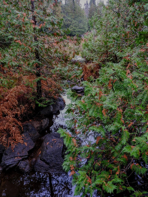
Description: Short and scenic, the trail follows along it's namesake. The river is actually the site of a glacial spillway running northeasterly and eventually flowing into Lake Superior. Much of the trail is shaded by the forest canopy. Cedar trees favour the river banks where running water can saturate their root systems. A wide variety of ferns and moisture loving plants grow on the cool damp forest floor. (Source: MNR Ontario)


___________
Trapper's Trail 

Difficulty: 1.5 km loop (Easy)

Description: The trail follows the shoreline of Rustle Lake. The area supports a variety of wildlife such as: beaver, otter, marten, heron and moose. Originally, Rustle Lake was nothing more than a wide portion of a forest stream. Beavers then damned it and aquatic life grew into the shallow waters, forming a wetland. The abundance of fur-bearing animals resulted in the establishment of a trapline - licensed to the Renner brothers in the 1930's and active until the mid-1970's. Trapper's Trail is only a small portion of their former trapline which extended along the Baldhead River to Lake Superior. (Source: MNR Ontario)


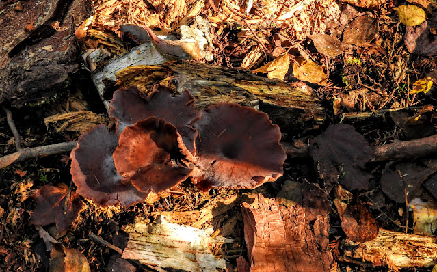
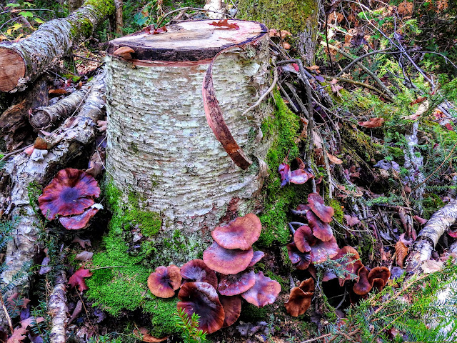
A mushroom community.


Isn't Nature amazing! ... the tricky fungus at top right has obviously disguised itself as a Fox turd to discourage squirrels and chipmunks from eating it.


Tendrils


Luv wetlands ...


___________
Pinguisibi Trail 

Difficulty: 6.0 km return, linear trail (Easy to Moderate)
Travelling upstream, a hiker will pass five significant rapids (some ledges and falls) with numerous rock gardens between. Steep trail sections are short and moderate only; with the exception of a medium length steep 'down' at about the 2 km location along the trail. Short steep sections are usually followed by long, fairly flat trail portions. This hike is one of the prettiest in the Park.

Description: Pinguisibi is the name for 'river of fine white sand'. This river was an ancient route of travel used by the Ojibwa as they hunted, fished and trapped northwards into the interior. Following the trail along the north bank of the and River, you will pass a series of waterfalls interspersed with rapids. (Source MNR Ontario)


I see a sneak route ...


_________________


We're LOAFin Around 

... follow along, if you like.
  
Refer to our Trips153/154 gallery for all the photography ... from 2021's summer and autumn of 'covid interrupted' road tripping adventures.

Camera: Nikon Coolpix P610

Unless noted, all content is by LOAFin Around. 


TEAM: LOAF, Crumby, Wry and Crusty 
__________________________________________________________

7 Oct 2021

EXCURSION: Ferris, Killbear and Pancake Bay Provincial Parks


We're on our way as far northwesterly along the Lake Superior shoreline as we can reach, before the 'snow flies' and then we'll head southerly for other 'pursuits'. For us that will mean returning home before Octobers' end ... we have about 3 weeks for LOAFin Around. 

We'll follow the colours and we'll hike. 


Viewing Tips: 

If you're a curious individual, click on these links for additional information.

If you're not, then ... double click on any photo to bring up a scrollable gallery of all photos in this post and eliminate all text.

______________________                                                                                                    

FERRIS Provincial Park

Ferris Provincial Park is in northeastern Northumberland County in Ontario, Canada. The park occupies an area of 1.98 km2 (0.76 sq mi) next to the Trent River in Campbellford, Ontario. Within the park are 10 kilometres of hiking and mountain biking trails and a suspension bridge over Ranney Gorge. Two campground areas offer 150 sites for car camping. The park's land was originally owned by James Marshall Ferris and his descendants. The province acquired the lands in 1960 (Cock farm section in 1969) and opened the provincial park in 1962. The park was threatened by closure in 1994, but saved by efforts from the members of the local Rotary Club. The Ranney Gorge suspension bridge was built by 8th Wing CFB Trenton from 2002 to 2004. (Source: Wikipedia)

Along the trails ...

Ranney Falls Trail - 1 km (Easy)

This trail follows the original roadway to Ferris Provincial Park before looping back along the river, where there are magnificent views of the Ranney Gorge Suspension Bridge and Ranney Falls. The gorge edge habitat supports different vegetation from the rest of the park, including the regionally rare Chinquapin Oak. (Source: Ontario Parks) 


Step stones.


Many sections of the ancient stone walls have deteriorated.


River Gorge Trail - 3.5 km (Easy to Moderate)

This trail offers magnificent views of the Trent River gorge from the Ranney Gorge Suspension Bridge, before continuing downstream past the old Ferris Quarry and onto the legendary “sheep wash”, now a picnic area. The trail continues south, following the river’s edge for more fantastic views of the Trent River. On your way back upstream the trail travels through meadows and past Ferris’s unique stone fences, some of which have recently been rebuilt. (Source: Ontario Parks)

Stock photo.


At Camp ...


Dann
found a nearby 'pile of rocks' and built a firepit ...


... for Helen


___________________                                                                                                     

KILLBEAR Provincial Park

KillBear Provincial Park is ecologically significant for its large and varied types of shoreline. The wetlands of the park support significant animal species including Spotted turtles, Blanding's turtles and eastern Massasauga rattlesnakes. Uplands support both the Hognose snake and five-lined Skink, both of which are considered species of special concern. There is also a population of Fox snakes, which use offshore islands extensively, and overwinter in hibernacula in the area. The park is one area within a larger significant landscape, the 30,000 islands along the eastern coast of Georgian Bay, which comprise the world's largest freshwater archipelago. (Source: Wikipedia)

Along the trails ... 

Lighthouse Point Trail - 0.8 km loop (Easy)

This short trail takes you to the tip of Killbear Point and offers superb views of Georgian Bay and interesting rockscapes. (Source: Ontario Parks)


Lookout Point Trail - 3.5 km loop (Moderate)

This trail winds through a variety of forest types and rock outcrops and provides a breathtaking view of Georgian Bay at the midway point. (Source: Ontario Parks)


Peter
and Liam; KillBear TrailCutters and Journeymakers.

' Journeymakers  are those people who elevate your travel experience with the passion and enthusiasm for the place they call home and for the interest and kindness they give you, the traveller. '


Peter & Liam's latest finished wetland boardwalk; making hiking easier for everyone.


______________________

PANCAKE BAY Provincial Park

Pancake Bay Provincial Park was established in 1968. Pancake Bay is a sheltered, south-facing bay on the eastern shore of Lake Superior, north of Sault Ste. Marie, Ontario, Canada. A 5.5-kilometre (3.4 mi) sand beach lines the bay of which 3.5 km are within the park boundary. The bay is sand filled and shallow, which helps to warm the lake. Ancient beach ridges are visible more inland. The ecology of the region is characteristic of the Great Lakes-St. Lawrence transition forest, but is a northern shelter for more southerly flora and fauna. The region is home to a number of regionally rare and vulnerable species, including Braun's holly fern, maidenhair spleenwort, sand reed and the majestic peregrine falcon.  (Source: Wikipedia)

Along the trails ...

Pancake Bay Nature Trail – 3.5 km (Easy)

The trail begins along the dramatic Lake Superior shoreline, takes you over forested ancient beach ridges, through a fascinating wetland and then ends along a shallow meandering creek. Highlights of the trail include a boardwalk crossing the wetland, spring and summer wildflowers and a huge billion year-old conglomerate boulder. (Source: Ontario Parks)


A ONE BILLION year old conglomerate ... (on the right)

It's all about the Fall fungi ...


This one was in a mostly shaded area but 'found the light'.


Flowers


Nurse stump


Something died, something lived.


Pitcher plant


I'm sure this is an Elm stump ... see the twisted sinew.


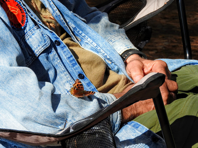
This butterfly stayed with me for several minutes. I was able to observe it collect and then drink from the tiniest water droplet that it had curled onto it's proboscis ... fascinating.

___________________________


We're LOAFin Around 

... follow along, if you like.
  
Refer to our Trips153/154 gallery for all the photography ... from 2021's summer and autumn of 'covid interrupted' road tripping adventures.

Camera: Nikon Coolpix P610

Unless noted, all content is by LOAFin Around. 


TEAM: LOAF, Crumby, Wry and Crusty 
__________________________________________________________