
Last Update: August 11, 2019
_________________________________________________________
" Paddling irons the wrinkles out of your soul. "
" Life is like a river, sometimes it sweeps you gently along and sometimes the rapids come out of nowhere. "
Anonymous
" Life is like a river, sometimes it sweeps you gently along and sometimes the rapids come out of nowhere. "
Emma Smith
_________________________________________________________
CONTENT
_______________________
This page contains a brief summary and a gallery of photos for many of our Paddling trips ... as day, multi-day or expedition ... by canoe, kayak and raft.
A complete portfolio of all trips is available by searching the Canoeing, Kayaking and Rafting labels under POSTS by INTERESTS.
Special Cases
Highlighted in BLUE, are a few cases where a portion of the trip necessitated travel by water taxi or tour boat.
Highlighted in BLUE, are a few cases where a portion of the trip necessitated travel by water taxi or tour boat.
Highlighted in GREEN are several trips that do not have an individual photo gallery or any journal information available. These are included as a secondary route in a more extensive trip or they may be described in a published blog post. Details about those would be found in other locations throughout the site.
A Word On Content
Trips are not presented here, in traditional tripping journal format as 'day to day' logs, nor are they intended to be paddling guides. The story of each, is best represented on this site, by our photos. However, we would gladly make ourselves available to paddlers interested in discussing any aspect of these trips, either through email correspondence or face to face. In most cases, our journals are well detailed and the information they provide would enhance any research already completed.
_________________________________________________________
VIEWING this Page
_______________________
Trips highlighted are now fully included and clicking on each takes you to a photo gallery.
For Details
Alternately, the PAGE scrolls down through all trips, from most recent to earliest, includes some additional information, (for those interested in more than just photos) and a clickable link to photography located at the end of each.
Explanations
* denotes incomplete trip information
Alternately, the PAGE scrolls down through all trips, from most recent to earliest, includes some additional information, (for those interested in more than just photos) and a clickable link to photography located at the end of each.
Explanations
* denotes incomplete trip information
_________________________________________________________
SOURCE of Posts
_______________________
Posts for this time period have been compiled from our hard-copy trip reports. They were initially, created and saved in 'scrapbook' form, then printed and stored in 3-ring binders as our KANOE TRIPPING Journal. Photography from trips completed in 2002 are a mix of analogue and digital. (Prior to June 1, 2002 all photography is analogue). Once a trip is fully compiled and included here, the content is copied from this page and a 'mock' post is created with any appropriate labels. The post is then published and becomes available for viewing in the left sidebar archive.
2002 - October 4, 2013
All photography from September 21, 2002 forward is digital. The same procedure as above is followed to create and publish a 'mock' post.
All photography from September 21, 2002 forward is digital. The same procedure as above is followed to create and publish a 'mock' post.
December 30, 2013 - Present
Posts are created, labelled, published and archived using standard blogger tools.
Posts are created, labelled, published and archived using standard blogger tools.
_________________________________________________________
Page STATUS
_______________________
Currently Compiling
TESLIN / YUKON Rivers
_________________________________________________________
BIG WATER
_______________________
_________________________________________________________
LAKES
_______________________
Algonquin PP 2010 Algonquin PP 2002-2000 Algonquin PP 1971-1974 Booth Lake Cabonga Reservoir Canadian National Adventure Racing Championship 2006 Conroy Marsh Frontenac PP Grande Lake Louisa Lake MKC: Open Tandem Canoe Clinic ORCA Canoe Tripping Instructor Certification ORCA Flatwater Instructor Certification Tea Lake Temagami 2019 Wabakimi PP
_________________________________________________________
RIVERS
_______________________
Allan Water AUX SABLES Barron Big Pigeon Blackfeather Creek / MOUNTAIN / MACKENZIE Blackwater * Bonnechere Caribou CHAGRAS DUMOINE 2004 / Ottawa DUMOINE 1999 / Ottawa FRENCH GREEN / COLORADO Jock Outlast Adventure Race Madawaska 2004-2002 Madawaska 2000 MISSINAIBI / North French / Moose Mississippi 2004 Myakka Nipissing Organos OTTAWA 2000 PETAWAWA 2013 PETAWAWA 2004 PETAWAWA 2002 PETAWAWA 1999 Rhine Rock Creek / Gordon SOUTH NAHANNI / LIARD St. Lawrence Takhini / WIND / PEEL TATSHENSHINI / ALSEK TESLIN / YUKON THIRTY MILE / YUKON Tim WEKWEYAUKASTIC / NORTH FRENCH / Moose
2018 - TESLIN / YUKON River(s) Yukon Territory CANADA
Trip 146.gif)
Trip 133
_________________________________________________________
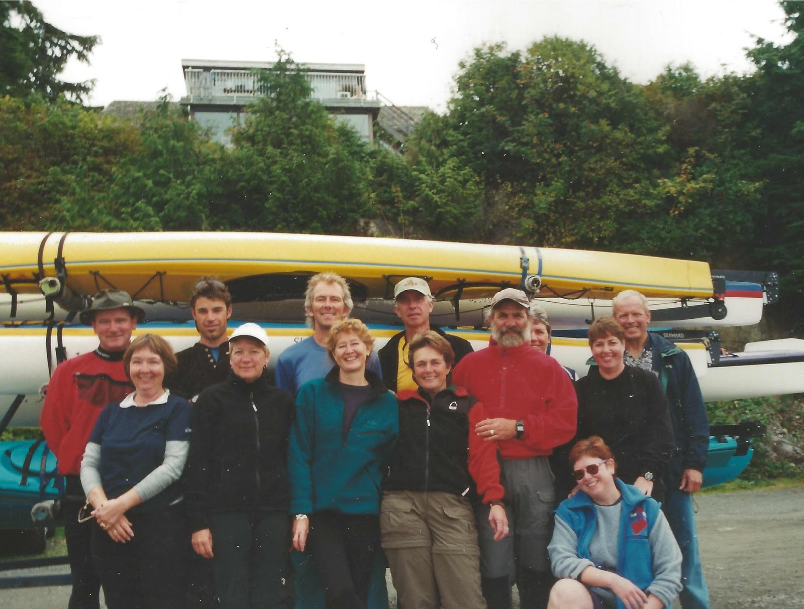
2019 - Temagami and Cross Lakes Ontario CANADA
Trip 148
Trip 148
LOGISTICS (ON CANADA)
Paddlers: Karen and Gerry, John, Helen and Dann
Getting There: It's about an 8 hr drive from Wellington, including a lunch break. Others had a slightly faster time.
Route: Temagami & Cross Lakes, Temagami Region, flatwater/bigwater, 6 nights, 70 kms
Paddlers: Karen and Gerry, John, Helen and Dann
Getting There: It's about an 8 hr drive from Wellington, including a lunch break. Others had a slightly faster time.
Route: Temagami & Cross Lakes, Temagami Region, flatwater/bigwater, 6 nights, 70 kms
TEMAGAMI Photography
2018 - TESLIN / YUKON River(s) Yukon Territory CANADA
Trip 146
The Launch of TEAM Four Degrees
LOGISTICS (YT and NT CANADA)
Paddlers: Katherine and Boyd, DM (Donna-Marie) and Bryan, Peggy and Tom, Helen and Dann
Van Shuttle: With Up North from Whitehorse YT to put-in at Johnson's Crossing, Teslin River
River Route: Teslin R @ Johnson's Crossing to Yukon R @ Carmacks, CI+, 12 river days, 370 kms
Van Shuttle: With Up North from take-out at Carmacks, Yukon River to Whitehorse
2014 - GREEN / COLORADO River(s), Utah, USALOGISTICS (YT and NT CANADA)
Paddlers: Katherine and Boyd, DM (Donna-Marie) and Bryan, Peggy and Tom, Helen and Dann
Van Shuttle: With Up North from Whitehorse YT to put-in at Johnson's Crossing, Teslin River
River Route: Teslin R @ Johnson's Crossing to Yukon R @ Carmacks, CI+, 12 river days, 370 kms
Van Shuttle: With Up North from take-out at Carmacks, Yukon River to Whitehorse
TESLIN / YUKON Photography
.gif)
It Was A GRAND Trip, But We've Never Felt Dirtier ... EVER!
LOGISTICS (UT, USA)
Van Shuttle: With Tex's Riverways from Moab > Crystal Geyser, GREEN River
Tandem Canoe: Crystal Geyser > (near) COLORADO R. confluence - Labyrinth & Stillwater Canyons, CI+, 9 days, 189 kms
Jet Boat: on the COLORADO from near the confluence with the GREEN > Potash Landing - 2 hrs, 80 kms
Bus Shuttle: With Tex's Riverways from Potash Landing > Moab
DVD Available: Get copy from Store
View Green / Colorado River(s), Utah, USA in a larger map
Campsites

We met a couple of paddlers from Whitehorse, YT, while waiting for the air charter out of our 2009 Wind / Peel River(s) trip - they recommended the Green. We certainly weren't disappointed. The desert landscape in these canyons is quite beautiful, not the type of terrain or geological formations we see in Canada - a geyser, some nice hikes intermixed with outlaw cowboy and aboriginal history, beautiful desert wildflowers, giant bats in the canyons, strange night bird calls, lizards, bobcat, coyote. The river is fairly slow and very silty, with few paddlers. We travelled late April / early May. We had mostly good weather. Very warm days and cool nights. I imagine this would be an extremely hot trip at anytime after early Spring, from mid May onwards. This is the same group of paddlers that did the Thirty Mile / Yukon River(s) trip in 2012 ... a good bunch, great campers and some excellent backcountry cooks.
Wikipedia: The Green River was known to the Shoshone Indians as the Seeds-kee-dee-Agie, or Prairie Hen River. This name, in one version or another, was later adopted and widely used by the mountain men. Dominguez and Escalante named the Green the Rio de San Buenaventura, but the river was known by later Spaniard and Mexican explorers as the Rio Verde, or Green River. This connection with the Spanish led to the Green being known for a time as the Spanish River, but by the time Ashley floated the Green in 1825, the name "Green River" was in common use. Accounts vary as to why the river is called the Green. One has it that it is because of the color of the water; another that it is named for a member of Ashley's original party of mountain men. John C. Fremont thought that the name came from the vegetation along the banks. No one account is authoritative.
GREEN

COLORADO
Typical canyon scenery and paddling conditions ...
Trip 131
Alligators, some Realllly BIG Alligators!
LOGISTICS (FL, USA)
Single Kayaks: From our site @ Camp Venice Retreat RV Park > north & south along the river - flatwater, 2 daytrips, 30 kms
View Myakka River, Florida, USA in a larger map
There's an Everglades feel to paddling along this narrow, intimate little river. And, who could pass up a chance to see a 10 foot alligator 'up close and personal'!
We had two good days paddling on the Myakka River. From our site, a short paddle intersects us with the river proper, where we can travel north or south - and we did just that. It’s a pretty river and fairly quiet. The palms and riverbank vegetation are thick along the shoreline and there are few takeouts, landings are very muddy. Most river traffic are kayakers and some fishing boats. Not an abundance of waterfowl, but enough to keep us interested. We saw several of the Herons - Blue and Little Blue and Green, Egrets, also Wood Storks and Belted Kingfishers, Osprey and a couple of Hawks we couldn’t identify. Sunday was cooler and we didn’t see any gators but Monday made up for it ... a dozen at least, one that was around 10 feet, a few 8 and 4 footers and one or two small ones. Alligators are only agressive when they are protecting their young or during the breeding season. Like any wild creature if you give them space they won’t bother you. We stayed in the middle of the river channel as much as possible and shot any pictures from a comfortable distance for both us and the gators.
But, it is somewhat unnerving to have a 10 footer slowly slide off the muddy bank as you paddle by, submerge all of its huge body ... except for the tip of it’s snout and two yellow eyes into the murky water and follow your boat for a distance. What is even more unnerving is when you look over your shoulder ... and the gator's NOT there any longer!
Trip 130
A Repeat River Trip Worth Repeating
LOGISTICS (ON, CANADA)
Partner: Fred Ingram
Private Vehicle: Tim's Lake > Perth > Lake Travers, Algonquin PP, ON
Shuttle Vehicle: By Algonquin Bound Outfitters from Lake Travers > McManus lake for pickup
Tandem Canoe: Lake Travers > McManus Lake - CII+ / CIII, 3 days, 50 kms
Portage: around Crooked Chute
Private Vehicle: McManus Lake > Perth > Tim's Lake
View Petawawa River, Ontario, CANADA in a larger map
Right in our backyard, logistics are easy, intermediate whitewater all mixed in with beautiful Shield country. I first paddled on the Petawawa as a Canoe Ranger in Algonquin Park in the early 70's. Over the years I have been on it's complete length, from the source at Ralph Bice Lake (Butt Lk.) to the Ottawa River confluence, except for a small section that runs through the military base at CFB Petawawa. A fellow canoeist, Rick Reid has been organizing annual Fall trips down this section for a couple of decades now. This is the second time I've joined them.

The Petawawa is a river in the Saint Lawrence River drainage basin in Nipissing District and Renfrew County in eastern and northeastern Ontario, Canada. The river flows from Algonquin Provincial Park to the Ottawa River at the town of Petawawa, and is only one of two major tributaries of the Ottawa River to flow completely free (the other being the Dumoine River. The river's name comes from the Algonquian for "where one hears a noise like this", which refers to its many rapids.
Excerpt from KANOE TRIPPERS Adventure Journal:
" It was really great to get in a boat again with Fred and share this tripping experience on the Petawawa. We haven’t paddled together since the Wekweyaukastic River in June of 2004. It was equally enjoyable to paddle with Rick and Doug again and to travel with some new paddlers, the father & son team of Steve & Dale. The ‘Pet’ is considered a jewel amongst eastern Ontario whitewater rivers - runnable rapids, nice Canadian Shield landscape and easy vehicle shuttling. Fred & I have promised to try to work this trip in as a tradition from now on and we plan on adding a couple of days fishing to push the overall length to 4 or 5 nights. "
... for the Wonderful CANADIAN History
LOGISTICS (YT, CANADA)
Designation: THIRTY MILE is a Canadian Heritage River
Van Shuttle: With UP NORTH Adventures from Whitehorse > Deep Creek, Lake Laberge
Water Taxi: With Up North from Deep Creek > (near the start of the) Thirty Mile River
Tandem Canoe: Lower Lake Laberge > Dawson City - CII, 11 days, 608 kms
Van Shuttle: With Up North from Dawson City > Whitehorse
Event: 38th Wedding Anniversary
DVD Available: Get copy from Store
View Thirty Mile / Yukon River(s) in a larger map
We chose this trip because of the pioneer and Goldrush history the river still offers up ... machinery from another time, sunken and dry-land riverboats, abandoned settlements, a restored and active HBC fort, a colourful historic town (Dawson City) at the take-out and the additional opportunity to paddle on another Canadian Heritage River.
THIRTY - MILE
YUKON
The Yukon River is a major watercourse of northwestern North America. The source of the river is located in British Columbia, Canada. The next portion lies in, and gives its name to Yukon Territory. The lower half of the river lies in the U.S. State of Alaska. The river is 1,980 miles (3,190 km) long and empties into the Bering Sea at the Yukon-Kuskokwin Delta.The average flow is 6,430 m³/s (227,000 ft³/s).The total drainage area is 832,700 km² (321,500 mi²), of which 323,800 km² (126,300 mi²) is in Canada. By comparison, the total area is more than 25% larger than Texas or Alberta. The longest river in Yukon Territory and Alaska, it was one of the principal means of transportation during the 1896–1903 Klondike Gold Rush.
A portion of the river —"The Thirty Mile" section, from Lake Laberge to the Teslin River is a Canadian Heritage River and a unit of Klondike Gold Rush Historical Park. Paddle-wheel riverboats continued to ply the river until the 1950s, when the Klondike Highway was completed. After the purchase of Alaska by the United States in 1867, the Alaska Commercial Fishery acquired the assets of the Russion-American Company and constructed several posts at various locations on the Yukon River.
Yukon means "great river" in Gwich’in The river was called Kuigpak, or "big river", in Central Yup’ik The Lewes River is the former name of the upper course of the Yukon, from Marsh Lake to the confluence of the Pelly River at Fort Selkirk.
THIRTY MILE / YUKON Photography
2011 - SOUTH NAHANNI / LIARD River(s), Northwest Territory, CANADA
Trip 122
If You're a Paddler, It's on YOUR List!
LOGISTICS (ON, CANADA)
Designation: SOUTH NAHANNI is a Canadian Heritage River
Private Vehicle: Tim's Lake > Toronto
By Air: Toronto > Edmonton, AB > Yellowknife, NT > Ft. Simpson, NT
Air Charter: With pilot Jaques Harvey of South Nahanni Airways from Ft. Simpson > Rabbitkettle Lake, Nahanni National Park
Outfitter: Blackfeather Wilderness Adventures
Guides: Paul Scriver, Andrew Pichora
Mandatory Portage(s): (1) Rabbitkettle Lk. > SOUTH NAHANNI R. (2) Around Virginia Falls
Tandem Canoe: SOUTH NAHANNI R. > Nahanni Butte, NT - CIII+, 13 days, 337 kms
Max. River Speed: 23 km/hr (gps)
Water Taxi: On the LIARD River from Nahanni Butte > Lindberg's Landing
Van Shuttle: Lindberg's Landing > Ft. Simpson
By Air: Ft. Simpson > Yellowknife > Edmonton > Toronto
Private Vehicle: Toronto > Tim's Lake
DVD Available: Get copy from Store
View South Nahanni / Liard River(s), NT, CANADA in a larger map
Bill Mason called it " The greatest river trip in the World"! ... What other reason would we ever need to paddle it?
Well OK!, these too ...
SOUTH NAHANNI

A statement of the Canadian Heritage River Systems:
The World’s first UNESCO site, inscribed in 1978. The South Nahanni is one of the world’s great rivers. It’s visitors are treated to a unique blend of scenic grandeur, wilderness adventure and solitude. Tumultuous rapids and meandering calm waters have cut deeply into the Dehcho (Mackenzie Mountains), creating four towering canyons (the deepest in Canada) and Virginia Falls, twice the height of Niagara Falls. Deep caves puncture the walls of Ala Tthe Zhihgoi?a (First Canyon). Gahnihthah (Rabbitkettle Hotsprings) have built the highest tufa mounds in Canada. In recognition of this unique heritage, the South Nahanni River has been proclaimed a Canadian Heritage River.
Advice given to Raymond Patterson in Fort Smith on his way to the Nahanni in 1927:
“ So you’re goin up the Big Nahanni?
Trip 119.gif)
Castles & Class I+
LOGISTICS (GERMANY)
Private Vehicle: Monsheim > Bacharach
Shuttle Vehicle: Bacharach > St. Gore
Tandem Canoe: Bacharach > St. Gore - CI+, day trip, 16 km
Private Vehicle: St. Gore > Monsheim
View Rhine River, GERMANY in a larger map
An urban paddle, but an opportunity to do so on one of Europe's great rivers, past castles and picturesque villages and joined by a couple of the German canoeists that we met on the WIND River in Yukon last season ... how could we possibly pass on that offer?

Old Friends on an Old Route
LOGISTICS
Double Blades
LOGISTICS
2009 - Takhini / WIND / PEEL River(s), Yukon Territory, CANADA
Trip 113
Helen's Choice for BEST River Trip EVER
LOGISTICS (YT, CANADA)
Van Shuttle: Whitehorse > Mayo
Air Charter: With pilot Ernie of Black Sheep Aviation from Mayo > McClusky Lake
Outfitter: Adventure Tours Yukon Wild
Guide: Georg Saure
Mandatory Portage: McClusky Lk. > put-in on McClusky Creek
Tandem Canoe: McClusky Creek, WIND R. > Taco Bar, PEEL R. - CII+, 16 days, 270 kms
Air Charter: With pilot Ernie of Blacksheep Airways from Taco Bar > Mayo
Van Shuttle: Mayo > Whitehorse
DVD Available: Get copy from Store
View Takhini / WIND / PEEL in a larger map
We warmed up on the Takhini, paddled the WIND from its' source at McClusky Lake to the confluence with the PEEL and finished with a few days on the PEEL. We chose this river primarily for the hiking opportunities ... they occur almost everywhere along the WIND's length, some minor bushwhacking, only moderate hiking grades, easy access to the alpine, superb views. Also, runnable rapids, easy white-water.


Trip 97.gif)
My 2 Seconds of Fame
LOGISTICS (ON, CANADA)
Cameraman: Al Joyner
Solo Canoe: Langford Nahanni @ the dam in Burnstown, Ontario
A friend, Al Joyner, needed a demonstration paddler to contribute and participate in some footage he was shooting, for an educational video for the Canadian government ... I volunteered, I got to pose a bit and it was fun.

2004 - DUMOINE / Ottawa River(s), Quebec / Ontario, CANADA
View 2004 DUMOINE / Ottawa in a larger map

View 2004 Petawawa River in a larger map

2004 - WEKWEYAUKASTIC / NORTH FRENCH / Moose River(s), Ontario, CANADA
Trip 93
To ... The BAY
LOGISTICS (ON, CANADA)
View 2004 WEKWEYAUKASTIC / NORTH FRENCH / Moose River(s) in a larger map
 Moose @ Moosenee Wharf
2004 - ORCA CT Instructor Level 2 Cert.: , Campbell's Bay & La Verendyre PP, PQ, CANADA
Trip 91
A Certification
LOGISTICS (PQ, CANADA)


Trip(s) 92 82 69
LOGISTICS (ON, CANADA)

2003 - FRENCH River, Ontario, CANADA
Trip 84
LOGISTICS (ON, CANADA)
View 2003 French River in a larger map
LOGISTICS (PQ, CANADA)
A Compilation of Several Short Trips
LOGISTICS
2002 - Blackfeather Creek / MOUNTAIN / MACKENZIE River(s), Northwest Territory, CANADA
Trip 71
Dann's Choice for BEST River Trip
LOGISTICS (NT, CANADA)


2002 - OTTAWA River, Ontario, CANADA
2002 - MADAWASKA River, Ontario, CANADA
2002 - AUX SABLES River, Ontario, CANADA
Trip 68
FIRST Guiding Job
LOGISTICS (ON, CANADA)
View 2002 Aux Sables River in a larger map
Grant Kennerley and I guided a group of Doctor's and a pharmaceutical rep down this river.

2002 - PETAWAWA River, Ontario, CANADA
Another River Trip
LOGISTICS (ON, CANADA)
Paddlers: Wanda & Al, Karen & Gerry, Heather & Fred, Rick & Me
Water Level: HIGH
Guide: 'Petawawa River Whitewater Guide' George Drought
Tandem Canoe: Lake Travers > McManus Lake - CII+ / CIII, 3 days, 50 kms
Portage: around Crooked Chute CIV
Skill Level: Intermediate - river,lake and wilderness travel, some rocky steep portages
Wildlife: Moose, Red Fox, Eastern Algonquin Wolf, many Raptors

2002 - Outlast Adventure Race, Jock River, ON, CANADA
Dann's First (and only) Adventure Race
Team: Chris Kurlicki, Bruce Schom, Me
Oldest Competitor This Race: Me @ 50
Support Crew: Helen, Mae, Earl
Disciplines: 5 km orienteering, treking, running, 16 km mountain biking, 10 km paddling, Total : 31 kms
Time: 5h 35m
Result: 6th place out of 23 teams, 4th in 3-man category
Photography: Scanned analog

We just wanted to complete this race, so we were all pleased and surprised to place as well as we did.
The weather was perfect - clear, sunny, not too hot. The trekking section was through marshy ground, included a dam section, some higher sections and abandoned farms. The overall route was very wet in places. In particular, the mountain biking section had many very low sections - some areas we carried the bikes through nearly waist high water. Very little grade throughout the bike section, but some of the trail surface was covered with sharp, 4 inch rip-rap stone and other sections were heavily rutted by ATV and 4x4 traffic. The paddle along the Jock River was predominantly flat-water but did include a half dozen or so swifts and one CI rapid, a number of gravely spots where we had to drag the canoe, a couple of lift-overs, meandering wetland sections and some stinky low spots enhanced by rotting (over wintered) carcasses of nearby dead animals.
There were no injuries during this race. Our gear held up fairly well, although near the end of the biking, both Chris's and my bikes were struggling with gear and chain issues.
All in all ... we had fun!
2001 - ORCA Canoe Tripping Level II Certification , MISSINAIBI / NORTH FRENCH / MOOSE Rivers, ON, CANADA
LOGISTICS (ON, CANADA)
LOGISTICS (ON, CANADA)
2001 - PETAWAWA River, Ontario, CANADA
2001 - Big Pigeon River, Tennessee, USA
2000 - CLAYOQUOT SOUND BC, CANADA
Trip 44
Sea Kayaking
LOGISTICS (BC, CANADA)
2000 - TATSHENSHINI / ALSEK Rivers, YT & BC, CANADA and AK, USA
Trip 43 .gif&container=blogger&gadget=a&rewriteMime=image%2F*)
FIRST Rafting Expedition
LOGISTICS (BC, CANADA)
Trip 041
Second Annual O'Kane Family Canoe Trip

2000 - Tea Lake , Algonquin PP, Ontario, CANADA
Trip 040
Brooks Family Camping Weekend

2000 - Ottawa River, Ontario, CANADA
Trip 037
Sport Rafting Daytrip

2000 - Louisa Lake, Algonquin PP, Ontario, CANADA
2000 - Open Tandem White-water Canoe Course, MKC, Madawaska R., ON, CANADA
2000 - Grande Lake, Algonquin PP, Ontario, CANADA
2000 - MADAWASKA River, Ontario, CANADA
1999 - BARRON River, Ontario, CANADA
1999 - DUMOINE / Ottawa River(s), Quebec / Ontario, CANADA
Four Seasons As A Canoe Ranger

I spent 4 seasons employed as an Algonquin Park Canoe Ranger with the Ministry of Natural Resources in Ontario in the early 1970's.
I only have a selection of very poor photos taken with an old instamatic camera. Some of these are real old - where I can, I have identified the location or the person. We were required by the MNR to keep journals of our trips and work schedules...and I did have copies of these, but unfortunately they were burnt in a garage fire. The following record that I have written was made about 30 years after this time period.
Our typical work season ran between 'school's end' in the late spring until mid-late September. I worked directly under Jack Borrowman and Danny Cotnam out of the East Gate. I paddled, portaged, hiked and worked with several partners...Gillis Mackey, Rob Gamble, Lawrence Cohen and Peter Croal in addition to a number of others whose names I have forgotten. We flew with Dave Campbell and Dave Croal using Beaver aircraft that departed from Pumphouse Lane in Pembroke and from Smoke Lake in the Park.
I began working in my first season with Gillis and Rob on the routes that started on lake Opeongo and headed out rom there. We worked throughout Opeongo - Happyisle - Merchant - Big Trout - White Trout (Trout Lake) - Burnt Island and Otterslide lakes to the west, Dicson - Wright and Booth Lakes to the east and Redrock, Big Crow and Proux to the north.
During my fourth and final season, I was given the responsibility for an area of my own .. the watershed of the Tim and parts of the Nipissing and Petawawa Rivers in the central west sector of Algonquin. The larger lakes maintained included Tim - Rosebary - Longbow - Devine - Little Trout, Queer and Butt and all the smaller lakes and ponds in between. We also ventured north of Tim Lake to trip through part of the Nipissing River and south of Butt and Big Trout Lakes. There are some photos of one of the fly-ins to the Tim River. Because of the semi-remoteness of the area a fly-in was the quickest way in, either that or a multi-day paddle. We followed the interior canoe routes and built bridges, cleaned up garbage, brushed portage trails, put out fires, maintained camp-sites, checked up on campers, erected toilets and dug pits.
Rob Gamble and I used our 4 days off one time to paddle a loop that departed from Cache and included: Head, Harness, Lawrence, Bonnechere, Big Porcupine, Ragged, Smoke, Little Island and Tanamakoon Lakes. There is also a small group of photos taken during a canoe trip with Dad, Tom and Wayne, but I can't remember where we went.
If You're a Paddler, It's on YOUR List!
LOGISTICS (ON, CANADA)
Designation: SOUTH NAHANNI is a Canadian Heritage River
Private Vehicle: Tim's Lake > Toronto
By Air: Toronto > Edmonton, AB > Yellowknife, NT > Ft. Simpson, NT
Air Charter: With pilot Jaques Harvey of South Nahanni Airways from Ft. Simpson > Rabbitkettle Lake, Nahanni National Park
Outfitter: Blackfeather Wilderness Adventures
Guides: Paul Scriver, Andrew Pichora
Mandatory Portage(s): (1) Rabbitkettle Lk. > SOUTH NAHANNI R. (2) Around Virginia Falls
Tandem Canoe: SOUTH NAHANNI R. > Nahanni Butte, NT - CIII+, 13 days, 337 kms
Max. River Speed: 23 km/hr (gps)
Water Taxi: On the LIARD River from Nahanni Butte > Lindberg's Landing
Van Shuttle: Lindberg's Landing > Ft. Simpson
By Air: Ft. Simpson > Yellowknife > Edmonton > Toronto
Private Vehicle: Toronto > Tim's Lake
DVD Available: Get copy from Store
View South Nahanni / Liard River(s), NT, CANADA in a larger map
Bill Mason called it " The greatest river trip in the World"! ... What other reason would we ever need to paddle it?
Well OK!, these too ...
The World's First UNESCO Site, inscribed 1978
Canada's Largest Tufa Mounds
The World's Largest Tufa Mounds North of Latitude 60
Canada's Deepest Canyon - First Canyon is 1200 metres high
The South Nahanni is a Canadian Heritage River
SOUTH NAHANNI
The World’s first UNESCO site, inscribed in 1978. The South Nahanni is one of the world’s great rivers. It’s visitors are treated to a unique blend of scenic grandeur, wilderness adventure and solitude. Tumultuous rapids and meandering calm waters have cut deeply into the Dehcho (Mackenzie Mountains), creating four towering canyons (the deepest in Canada) and Virginia Falls, twice the height of Niagara Falls. Deep caves puncture the walls of Ala Tthe Zhihgoi?a (First Canyon). Gahnihthah (Rabbitkettle Hotsprings) have built the highest tufa mounds in Canada. In recognition of this unique heritage, the South Nahanni River has been proclaimed a Canadian Heritage River.
Advice given to Raymond Patterson in Fort Smith on his way to the Nahanni in 1927:
“ So you’re goin up the Big Nahanni?
Boy you’ve bitten off something this time!
They say there’s canyons in there thousands of feet deep, and water coming through faster’ n hell.”
“But people have gotten through, haven’t they?”
“Oh, I guess they have just got through ... years ago.
But canyons ... and sheer! Thousands of feet!”
“If people have got through, there must be some ledges or something where a man can tie a canoe and camp and sleep?”
“I don’t know. There ain’t that many that have come back to tell about it.
Men vanish in that country.
There were some prospectors murdered in there not so long ago, and down the river they say it’s a damned good country to keep clear of ...”
SOUTH NAHANNI / LIARD Photography
2011 - Conroy Marsh, ON, CANADA
LOGISTICS

2010 - Rhine River, GERMANY2011 - Conroy Marsh, ON, CANADA
Trip 121
LOGISTICS
Shuttle: Black Donald Lake > Silgrey Rustic Resort, Boulter
Put-In: Conroy Rapids, York River
Put-In: Conroy Rapids, York River
Tandem Canoe: Conroy Marsh - FW, day trip, 16 km
Take-Out: Burnt Bridge Road where it crosses the Little Mississippi River
Gerry's cousin and husband own White Pine Lodge on Black Donald Lake. We all gathered there, spent a night in the cabins and did a day trip into the Marsh ... pleasant paddling and just 'way too many laffs'!Take-Out: Burnt Bridge Road where it crosses the Little Mississippi River
Trip 119
Castles & Class I+
LOGISTICS (GERMANY)
Private Vehicle: Monsheim > Bacharach
Shuttle Vehicle: Bacharach > St. Gore
Tandem Canoe: Bacharach > St. Gore - CI+, day trip, 16 km
Private Vehicle: St. Gore > Monsheim
View Rhine River, GERMANY in a larger map
An urban paddle, but an opportunity to do so on one of Europe's great rivers, past castles and picturesque villages and joined by a couple of the German canoeists that we met on the WIND River in Yukon last season ... how could we possibly pass on that offer?
Rhine Photography
2010 - Algonquin Park 2010, ON, CANADA
Trip 117.gif)
Old Friends on an Old Route
LOGISTICS
Private Vehicles: Tims Lake & Ottawa > Algonquin PP and return
Put-In: Rock Lake
Put-In: Rock Lake
Tandem Canoe: Rock Lk > Pen Lk > Clydegale Lk > Pen Lk > Galipo R > Welcome Lk >
Harry Lk > Rence Lk > Frank Lk > Florence Lk > Louisa Lk > Rock Lk
Distance: 45 kms
Portages: (8) 16.7 kms
Take-Out: Rock Lake
Excerpt from KANOE TRIPPERS Adventure Journal:Harry Lk > Rence Lk > Frank Lk > Florence Lk > Louisa Lk > Rock Lk
Distance: 45 kms
Portages: (8) 16.7 kms
Take-Out: Rock Lake
'It isn't often that we get an opportunity to relive our life experiences from a previous time and place. This canoe trip gave me that chance. '
Peter Croal and I worked together as Canoe Rangers for the Ontario MNR in the early 1970's. We lost touch with other for a period of time when family responsibilities and employment opportunities sent us down different paths. We reconnected several years ago and we've stayed in touch since, through emails and dinners at each others homes.
It's 36 years later now and we've embarked on a one week canoe trip to rekindle an old friendship and to resurrect the memories we each have from those seasons spent working and paddling together in Algonquin PP.

2010 - Cabonga Reservoir, La Verendyre PP, PQ, CANADA
Trip 116
Double Blades
LOGISTICS
Private Vehicles: From our homes > Le Domaine, La Verendyre and return.
Put-In: Cabonga 5
Put-In: Cabonga 5
Tandem Kayak: Cabonga 5 > Site 25-228 > (3) nights @ Site 25-208 > (2) nights @ Site 25-232 > Cabonga 5
Distance: 94.85 kms (gps)
Portages: (2) 0.13 kms (gps)
Take-Out: Cabonga 5
View Larger Map
Excerpt from KANOE TRIPPERS Adventure Journal:
The Cabonga Reservoir is a man-made lake in central Quebec, fully within the La Verendyre Wildlife Reserve. It's name is derived from the Algonquin 'kakibonga' and means, 'completely blocked by sand'.
Before its' impoundment, Lake Cabonga was considered the largest body of water between the Gatineau and Ottawa Rivers. In 1928 - 1929, a dam at the outlet of the lake, the Gens de Terre River, was constructed to create a reserve for logging companies to float their logs downstream. Some 37 natural lakes were thus combined and formed a single reservoir with an area of 404 square kilometres, 4500 kilometres of shoreline and dotted with innumerable islands and shallow bays.
Cabonga Reservoir Photography
Helen's Choice for BEST River Trip EVER
LOGISTICS (YT, CANADA)
Van Shuttle: Whitehorse > Mayo
Air Charter: With pilot Ernie of Black Sheep Aviation from Mayo > McClusky Lake
Outfitter: Adventure Tours Yukon Wild
Guide: Georg Saure
Mandatory Portage: McClusky Lk. > put-in on McClusky Creek
Tandem Canoe: McClusky Creek, WIND R. > Taco Bar, PEEL R. - CII+, 16 days, 270 kms
Air Charter: With pilot Ernie of Blacksheep Airways from Taco Bar > Mayo
Van Shuttle: Mayo > Whitehorse
DVD Available: Get copy from Store
View Takhini / WIND / PEEL in a larger map
We warmed up on the Takhini, paddled the WIND from its' source at McClusky Lake to the confluence with the PEEL and finished with a few days on the PEEL. We chose this river primarily for the hiking opportunities ... they occur almost everywhere along the WIND's length, some minor bushwhacking, only moderate hiking grades, easy access to the alpine, superb views. Also, runnable rapids, easy white-water.
The Wind River has its beginnings in the magnificent Wernecke Mountains, about 135 kilometres northeast of the small village of Mayo in the centre of the Yukon’s Boreal Forest. It drains into the Peel River, 200 kms to the north, which in turn carries on to the mighty Mackenzie and finally out to the Beaufort Sea in the Arctic Ocean. It share’s this area with several other sister rivers from the Peel River watershed, the Ogilvie, Blackstone, Hart, Bonnet Plume and Snake and a number of other smaller rivers and creeks.
In 2003, CPAWS undertook to bring public awareness to the area by embarking on trips down the 3 most prominent rivers in the group; the Wind, Snake and Bonnet Plume.
Richard Nelson, an award winning Alaskan author made the following observation after participating in the Three Rivers CPAWS initiative as a paddler. The Wind, along with the Snake and the Bonnet Plume are those three rivers ……..
‘Even after 40 years of travel into the remotest parts of Alaska, I was astounded by the magnitude of wildness and beauty. This journey took us into one of the largest, most spectacular, pristine wild lands remaining on earth – the Boreal Forest of Canada. For most Americans, Alaska is the purest icon of wilderness. What they know of Canada is shaped almost entirely by the narrow sliver of tamed, cultivated and urbanized land just above the Canadian border. Even in these days of growing environmental awareness, few Americans have any comprehension that they live adjacent to the largest expanse of untrodden, uncut, undiminished forest anywhere on Earth.
I gradually came to realize that the Canadian Boreal is to Alaska what Alaska is to New Jersey.’
Takhini
WIND
PEEL
Takhini / WIND / PEEL Photography
The WORLD"S Largest Wilderness Canoeing Region ... and Gerry caught fish every day!
LOGISTICS
Private Vehicles: All our homes to Armstrong, ON
Jan & Keith's FIRST Canoe Camping Trip
LOGISTICS

2006 - Canadian National Adventure Racing Championship, Timmins, ON, CANADA
Trip 101
LOGISTICS
2005 - Organos River, COSTA RICA
2004 - Mississippi River, Ontario, CANADA
2008 - Wabakimi PP, ON, CANADA
Trip 108
The WORLD"S Largest Wilderness Canoeing Region ... and Gerry caught fish every day!
LOGISTICS
Private Vehicles: All our homes to Armstrong, ON
First Night's Accommodation: Mattice Lake Outfitters
Air Charter: Air Mattice
Planes: Single Turbo Otter & Beaver
Pilot(s): Don Elliot, unknown
Tandem Flatwater Tripping Canoe(s): some CI+, high water, some travel on the Allan Water & Caribou rivers
Van Shuttle (from take-out): Mattice Lake Outfitters
DVD Available: Get copy from Store

Air Charter: Air Mattice
Planes: Single Turbo Otter & Beaver
Pilot(s): Don Elliot, unknown
Tandem Flatwater Tripping Canoe(s): some CI+, high water, some travel on the Allan Water & Caribou rivers
Van Shuttle (from take-out): Mattice Lake Outfitters
DVD Available: Get copy from Store
We booked an air charter with Mattice Lake Outfitters and flew into Granite Lake. Flight time was 08:45 am. First time in a single-engine Turbo Otter for both of us. We found out at the end of the trip that this plane was built in 1956. The two Beavers used by Mattice Lake Outfitters are built in 1951 and 1953. All aircraft are in fine shape. The flight in was about ½ an hour. Staff load all the gear and secure the boats to the aircraft pontoons. We’re with Fred & Heather and Karen & Gerry will fly in one of the Beavers. The flight in gave us a good aerial perspective of the type of terrain we’ll be paddling through over the next 2 weeks …… the Northern Boreal. Gear and boats were offloaded on the water – a first for me. Thankfully we had calm conditions.
We set up and then did a short paddle south on the lake and then around the point where we were camped and into a backwater channel with a short lift-over back to camp ...
Wikipedia: Wabakimi Provincial Park is a wilderness park located to the north-west of Lake Nipigon and north-west of Armstrong Station in the province of Ontario, Canada. The park contains a vast and interconnected network of more than 2,000 kilometres of lakes and rivers and is considered to be the world’s largest wilderness canoeing region. The park covers an area of 8,920 km² and became the second largest park in Ontario and one of the world's largest boreal forest reserves following a major expansion in 1997. Paddlers often travel the Allan Water, Flindt, Pikitigushi, and Ogoki River during the summer months. Wabakimi Provincial Park's waterways straddle a height-of-land from which water flows either to the Atlantic Ocean via Lake Superior or to the Arctic Ocean via the James Bay/Hudson Bay basins.
2008 - Frontenac PP, ON, CANADA
Trip 107
Jan & Keith's FIRST Canoe Camping Trip
LOGISTICS
Private Vehicles: A short, approximately 10 km drive from home to the park.
Tandem Tripping Canoe(s): lake paddling, no portages
Frontenac PP Photography
Trip 101
Safety Boat
LOGISTICS
Private Vehicle: Home > Timmins
Wanapitie Suburban / Boat Trailer: Timmins > Lady Evelyn PP
Partner(s): Unknown bow paddler & co-driver
Partner(s): Unknown bow paddler & co-driver
Shuttle: Moved 15 canoes in a single load to the start of the paddling segment
Portage: One miserable portage, poorly marked & documented, partly by atv through heavy marshland
Tandem Canoe: lake paddling
Wanapitie Suburban / BoatTrailer: Lady Evelyn PP > Wanapitie Outfitters Base
Private Vehicle: Wanapitie Outfitters Base > Home
Private Vehicle: Wanapitie Outfitters Base > Home
Shawn Hodgins from Wanapitei Canoe contacted me to work this race. He had been approached by race officials interested in arranging for a large boat rental, securing a driver to shuttle 30 canoes from location to location around the course and a canoe guide to work as boat safety at one of the manned checkpoints. I was to be assisted with another one of Shawn’s staff, Janice Wing, during the boat shuttling and the race organizers would provide me with a bow paddler while I was stationed at a remote paddling checkpoint (CP). Also, other ‘race volunteers’ would be camped with me at the CP and would handle most of the regulatory details as teams crossed. My primary role would be to provide rescue if needed. It was also possible that I would be dispatched downriver to several rapid locations if there was an emergency requirement for extraction.
I found it very interesting to work as a crew member for an adventure race, especially one of the caliber of the Canadian National Race. I was impressed with the levels of fitness and endurance exhibited by racers, the large numbers of volunteer staff required to assist in handling race logistics and the professionalism of local Search and Rescue and Medical Paramedic teams.

Trip 98.gif)
View 2005 Organos River, COSTA RICA in a larger map
This trip was not planned. Helen and I had booked a 3 night guided trip to circumnavigate Isla Tortuga. Helen slipped on the pool deck at the Costa Coral Resort where we were staying and broke her kneecap. I did a daytrip to this nearby local river.

LOGISTICS (COSTA RICA)
Guides: Kat & Nate
Van Shuttle: With Crystal Seas from Costa Coral Resort, Playa Tambor > ORGANOS R., Playa Organos & return
Van Shuttle: With Crystal Seas from Costa Coral Resort, Playa Tambor > ORGANOS R., Playa Organos & return
Single & Double Kayak(s): Up the Organos for several kilometres and return - C1+ (surf landings)
View 2005 Organos River, COSTA RICA in a larger map
This trip was not planned. Helen and I had booked a 3 night guided trip to circumnavigate Isla Tortuga. Helen slipped on the pool deck at the Costa Coral Resort where we were staying and broke her kneecap. I did a daytrip to this nearby local river.
Excerpt from KANOE TRIPPERS Adventure Journal:
" We're not sure what may develop with Helen's knee, so we have decided that I will do day trips with Crystal Seas and she will recuperate at the resort. The north winds are fierce along this coast right now ... major breakers, huge swells, whipped spray. The local fisherman aren't going out, so we will stay away from big water paddling today and head to a nearby local river for some inland paddling in a mangrove area. Even though we arrived at the put-in quite early, the winds had already begun to churn the waves into considerable surf at the mouth of the estuary. Later we would roll both kayaks at the end of a landing, almost nailed it ... "
Organos Photography
Trip 97
My 2 Seconds of Fame
LOGISTICS (ON, CANADA)
Cameraman: Al Joyner
Solo Canoe: Langford Nahanni @ the dam in Burnstown, Ontario
A friend, Al Joyner, needed a demonstration paddler to contribute and participate in some footage he was shooting, for an educational video for the Canadian government ... I volunteered, I got to pose a bit and it was fun.
Trip 96
One of the Better Whitewater Training Rivers
LOGISTICS (ON / PQ, CANADA)
One of the Better Whitewater Training Rivers
LOGISTICS (ON / PQ, CANADA)
Partner: Greg Fox
Private Vehicle: Kanata > Deep River > Driftwood PP, Ottawa R., ON
Private Vehicle: Kanata > Deep River > Driftwood PP, Ottawa R., ON
Bus Shuttle: With Wanapitei CANOE from Driftwood PP > Lac Benoit, DUMOINE R., PQ
Tandem Canoe: Lac Benoit > OTTAWA R. confluence > Driftwood PP - CII+ / CIII, 5 days, 64 kms.
Private Vehicle: Driftwood PP > Perth & Kanata
View 2004 DUMOINE / Ottawa in a larger map
As guides for Wanapitei CANOE, Fred Ingram and I took a small group of paddlers down this section of the DUMOINE river.
Excerpt from KANOE TRIPPERS Adventure Journal:
" This is a very pretty river. It is quite narrow and intimate throughout most of its' drop to the Ottawa River. The Dumoine plunges 500 feet down the rocky, granite margin of the Laurentian Highlands, flowing 90 kms south out of Lac Dumoine and emptying into the low lying Ottawa River Valley. We paddled a little over 60 kms by entering just above Lac Benoit. The river is interspersed with picturesque lakes and framed by steep-sided, pine covered hills. For most of its' length the river traces a path of rapids and falls, over 30 sets can be run at most times of the season. "
DUMOINE 2004 / Ottawa Photography
LOGISTICS

Notes: Visited the Agawa Rock pictographs, hiked a section of the Coastal Backpacking Trail near Sinclair Cove, hiked near Gargantua Harbour, paddled to Warp Bay, hiked the Gargantua Bay portage trail
2004 - PETAWAWA River, Ontario, CANADA
2004 - Lake Superior PP, ON, CANADA
Trip 95a
LOGISTICS
Route: Mississagi PP > Site#35, Cresent Lk. CG, Lake Superior PP > Gargantua Bay
Paddlers: Chris, Heather, Fred, Helen, Dann
Paddlers: Chris, Heather, Fred, Helen, Dann
LAKE SUPERIOR PP Photography
2004 - PETAWAWA River, Ontario, CANADA
Trip 94
Canadian Military Adventure Training Exercise
LOGISTICS (ON, CANADA)
Canadian Military Adventure Training Exercise
LOGISTICS (ON, CANADA)
Partner: Laird
Private Vehicle(s): Kanata > Cedar Lake, Algonquin PP, ON
Private Vehicle(s): Kanata > Cedar Lake, Algonquin PP, ON
Tandem Canoe: Cedar Lake > McManus Lake, PETAWAWA R., - CII+ / CIII, 8 days, 89 kms
Private Vehicle(s): McManus Lake, Algonquin PP. > Kanata
View 2004 Petawawa River in a larger map
I was hired by PMH Outdoors to teach flatwater paddling skills with Pat Hawkins at Camp Otterdale in Lombardy, ON. After that job I was to connect with a number of DND personal who were completing an Adventure Training course on the Petawawa. I took one of the trainees in the bow of my canoe. Bruce Hawkins was leading the group.
Trip 93
To ... The BAY
LOGISTICS (ON, CANADA)
Partner: Fred Ingram
Private Vehicle: Kanata & Perth > Cochrane > Wekweyaukastic Lake
Private Vehicle: Kanata & Perth > Cochrane > Wekweyaukastic Lake
Shuttle Driver: Terry O'Neill drove Fred's truck from the put-in @ Wekweyaukastic Lk. and moved it to the Cochrane train station for our return trip.
Tandem Canoe: Wekweyaukastic Lake > WEKWEYAUKASTIC R. > NORTH FRENCH R. > Moose R. > Moose Factory > Moosonee, ON - CII+ / CIII, 13 days, 245 kms
Train: Polar Bear Express from Moosenee > Cochrane
Private Vehicle: Cochrane > Kanata & Perth
Private Vehicle: Cochrane > Kanata & Perth
View 2004 WEKWEYAUKASTIC / NORTH FRENCH / Moose River(s) in a larger map
Excerpt from KANOE TRIPPERS Adventure Journal:
" A bazillion biting insects
10140 metres of loaded carries across portages
6760 metres walked across portages
244.5 river kms paddled
80 kms of whitewater
countless swifts, CI's, II's and III's
many ledges & waterfalls
24 plus beaver dams
20 plus log jams
13 portages
12 camps made
10 days out of 12 with precipitation
5 camps bushwacked
1 portage bushwacked "
WEKWEYAUKASTIC
Moose @ Moosenee Wharf
Excerpt from 'Wakwayowkastic River Canoe Guide' by George Drought:
" The Wakwayowkastic River is a remote, little known river in north-eastern Ontario. The river has been used extensively by the natives of the area for fishing, trapping and hunting and in the late 19th century, it was part of one of the winter routes used by the packateers and mail carriers between Moose Factory and Cochrane. Some of the winter routes are still in evidence, winding their way through beautiful untouched jack pine forests.
Until the Wakwayowkastic joins with the North French River it is a small river, very dependent on snow melt and rainfall for canoe-able conditions. It is therefore necessary to paddle it early in the year in June or July. If you wait until August you could end up walking most of the 230 km. It rises in Wakwayowkastic Lake and for the first 50 km it is a tiny, twisty, beaver dammed and log jammed stream. It then opens up and is easier canoeing for the next 50 km.
The real white-water fun begins at approximately the 100 km mark and the river starts dropping off the Canadian Shield plateau with its swamps and muskeg. For 45 km there are a series of good rapids to run and waterfalls to carry or line around. Portages for the most part are non existent or are remains of the old winter trails up the river. The final rapid in this stretch is an easy but fairly long run as you paddle it you can see the transition from Canadian Shield to James Bay Lowland.
The final 85 km down the North French River and the Moose River is through limestone lowlands with ledgy limestone rapids in the odd place and there is wind and tide to face on the Moose River. The tide on James Bay comes up as high as the mouth of the North French. There are also masses of fossils to look at, and study, every time you beach your canoe.
The river has been paddled in 10 days but anyone considering doing it would be well advised to allow a minimum of 12 days. "
WEKWEYAUKASTIC / NORTH FRENCH / Moose Photography
Trip 91
A Certification
LOGISTICS (PQ, CANADA)
Partner: Fred Ingram
Private Vehicle: Kanata & Perth > Bear Creek
Accommodation: Bear Creek Outdoor Centre, Campbell's Bay, Quebec
Director: Jill Baxter
Instructors: Shawn Hodgins, Francis Boyes
Private Vehicle: Kanata & Perth > Bear Creek
Accommodation: Bear Creek Outdoor Centre, Campbell's Bay, Quebec
Director: Jill Baxter
Instructors: Shawn Hodgins, Francis Boyes
Shuttle: Driver Mike from Bear Creek > La Verendyre PP put-in @ Lac Fusel and return
Route: Lac Fusel > Lac Fabrezan > up Riviere de Rapids > Lac Poulter > south end Lac Poulter > Lac Jean Pierre > Lac Richet > Lac Antostagen > Take-Out @ Secondary Road #20
Route: Lac Fusel > Lac Fabrezan > up Riviere de Rapids > Lac Poulter > south end Lac Poulter > Lac Jean Pierre > Lac Richet > Lac Antostagen > Take-Out @ Secondary Road #20
Tandem / Solo Canoe(s): La Verendyre PP lakewater trip, PQ - flatwater, 5 days, 43kms
Certification Obtained: ORCA Canoe Tripping Instructor Level 2
Private Vehicle: Bear Creek > Kanata & Perth
Private Vehicle: Bear Creek > Kanata & Perth
We spent a couple of days at base camp participating in formal presentations, group discussions and practical exercises. At some time during the 9 days, each of us was tasked with a formal theory presentation, and an on-the-trail teach. We were then shuttled to reserve Faunique La Verendrye for a 5 day canoe trip. During the canoe trip we were responsible for acting as Leader and Navigator at separate times for at least one leg of the trip. After our return we had a couple of formal written examinations that were followed up with a private meeting with the instructors and a summary of our abilities. As successful candidates we were also presented with the ORCA certifications at this time.
Definitely the best Outdoor Education course I have ever attended. The base camp facilities, lodging and meals were very good. The course directorship and instruction was top notch. The choice to trip in La Verendrye was a good one. Guest speakers for a couple of the presentations were experts in their respective fields. The group was co-operative, friendly, helpful and brought a wealth of knowledge and experience to the course.
2004 to 2002 - MADAWASKA River, Ontario, CANADATrip(s) 92 82 69
LOGISTICS (ON, CANADA)
Private Vehicle: Kanata > Jessup's Campground, Palmers' Rapid
Solo & Tandem Canoe(s): At Palmers Rapid, Madawaska River
Private Vehicle: Palmer's Rapid > Kanata
Dates: June 9 - 11, 2004 / June 21 - 22, 2003 / June 22 - 23, 2002
Dates: June 9 - 11, 2004 / June 21 - 22, 2003 / June 22 - 23, 2002
A bunch of us gathered several times at Palmers for some training.
2003 - St Lawrence River, Ontario, CANADA
Trip 86
LOGISTICS (ON, CANADA)
LOGISTICS (ON, CANADA)
Trip 84
Designation: FRENCH is a Canadian Heritage River
Private Vehicle: Kanata > Sudbury > Hartley Bay
Tandem Canoe: Hartley Bay > Western / Voyageur / Main Channels French R > Hartley Bay - CII, 6 days, 54 kms
Private Vehicle: Hartley Bay > Sudbury > Kanata
View 2003 French River in a larger map
FRENCH
2003 - ORCA Flatwater Instructor Certification , Rideau Canoe Club, Rideau River, ON, CANADA
Trip 79
A Certification
LOGISTICS (PQ, CANADA)
Certification By: PMH Outdoors
Instructor: Bruce Hawkins
Courses: ORCA Flatwater Canoe Instructor, Lakewater 1

Instructor: Bruce Hawkins
Courses: ORCA Flatwater Canoe Instructor, Lakewater 1
This course fulfilled all my expectations and I was successful at obtaining both certifications.
ORCA Flatwater Instructor Certification Photography
2002 to 2000 - Algonquin PP - ON, CANADA
Trip(s) 74 70 60 51 46
A Compilation of Several Short Trips
LOGISTICS
Trips: Booth Lake, Canisbay Lake, Head Lake, Oxtongue Lake, Canoe Lake Loop
Paddlers: Mavis & Eric McGuinn, Heather Elliot & Fred Ingram, US

Booth Lake
A couple of short portages (25 and 550m) are required to access Booth Lake. Lining is possible in any water levels. Both portages are easy, however the 550m has some short vertical grade in spots. Both portages can be eliminated during medium and high water when the rapids can be run - a swift and CI only. Total travel time is 2 to 3 hours from Crotch to Farm to Kitty to the big island on Booth. The only difficulty that may be encountered would be high winds on Booth. This is a good introductory trip for beginner paddlers or families with young children.
There are several possible day trips that can be made from here and there is some nice hiking on the Booth Lake islands and along some of the adjacent shoreline. Camp-sites vary from private island sites to several nice sandy sites along the eastern shoreline. The camp-sites at the entrance to McCarthy Creek and the last one in the big bay just past our island site were a couple of the better ones. This second site allows for quick access to some nice ridge hiking. An old ranger cabin is available for rent to paddlers. It can be reached by paddling to the end of Booth Lake where the Opeongo River confluences.
There are several possible day trips that can be made from here and there is some nice hiking on the Booth Lake islands and along some of the adjacent shoreline. Camp-sites vary from private island sites to several nice sandy sites along the eastern shoreline. The camp-sites at the entrance to McCarthy Creek and the last one in the big bay just past our island site were a couple of the better ones. This second site allows for quick access to some nice ridge hiking. An old ranger cabin is available for rent to paddlers. It can be reached by paddling to the end of Booth Lake where the Opeongo River confluences.
Canisbay Lake
Head Lake
Oxtongue Lake
Canoe Lake Loop
Algonquin PP 2002 - 2000 Photography
Trip 71
Dann's Choice for BEST River Trip
LOGISTICS (NT, CANADA)
Air Travel: Ottawa > Edmonton > Yellowknife > Norman Wells
Air Charter: North Wright Airways from Norman Wells > Willowhandle Lake
Outfitter: Blackfeather Wilderness Adventures
Guides: Wendy Grater, Jamie Gupthill
Mandatory Portage: Willowhandle Lk. outlet > Push-Me Pull-You Creek > Blackfeather Creek
Tandem Canoe: Blackfeather Creek > MOUNTAIN R. > MACKENZIE R. confluence - CII+ / CIII+, 12 days, 308 kms
Water Taxi: Mackenzie R. confluence > Norman Wells
Air Travel: Norman Wells > Edmonton > Ottawa
Publication: Our trip was featured as article " Coming Down the Mountain " by Larry Rice, Canoe & Kayak Magazine, August 2003
Event: 28th Wedding Anniversary
DVD Available: Get copy from Store
View 2002 Blackfeather Creek / MOUNTAIN / MACKENZIE in a larger map
Excerpt from KANOE TRIPPERS Adventure Journal:
" We have a long list of rivers that we want to paddle, so selecting one for this trip was a very difficult choice. We would be celebrating our 28 th wedding anniversary, so it was also special for that reason. It was chosen on the advice of Karen and Gerry, who paddled it in 1991 and the fact that it has won “Guides Choice” by the Canadian River Guiding Community for several years now. It was picked over comparable rivers like the Nahanni, Hood and Stikine. We certainly weren’t disappointed.
What we got, was twelve exhilarating river days of seemingly continuous white-water. A twisting, braided, pushy course of water that widens constantly after it’s confluence with Blackfeather Creek. It becomes several 100 metres across at the mouth as it merges with Canada’s longest river; the MACKENZIE, just upstream from Norman Wells. This trip had it all; an exciting alpine plane flight through the Mackenzie Mountains, constant current, technical white-water, beautiful canyons, several great hikes, wildlife, superb views, tufa mounds, warm springs, flowerpot rocks, and good food and companionship.
It was our first extended canoe trip on a northern river and it will be hard to ‘Top’! "
Mini Canyon in Blackfeather Creek
MOUNTAIN
MACKENZIE @ the MOUNTAIN confluence
2002 - MADAWASKA River, Ontario, CANADA
2002 - AUX SABLES River, Ontario, CANADA
Trip 68
FIRST Guiding Job
LOGISTICS (ON, CANADA)
Partner(s): Several of the clients
Air Travel: Ottawa > Sudbury
Shuttle: Sudbury > Chelmsford > Bull Lake > along Massey Tote Road to first right after Bull Lk. Lodge > Put-in @ first bridge crossing
Tandem Canoe: Bridge crossing > AUX SABLES R., > oxbow @ UTM N5127500 E413300 - 2 day, CII+, 40 kms.
Shuttle: return to Sudbury > Sudbury Airport
Air Travel: Sudbury > Ottawa
View 2002 Aux Sables River in a larger map
Grant Kennerley and I guided a group of Doctor's and a pharmaceutical rep down this river.
AUX SABLES Photography
Trip 67
Another River Trip
LOGISTICS (ON, CANADA)
Paddlers: Wanda & Al, Karen & Gerry, Heather & Fred, Rick & Me
Water Level: HIGH
Guide: 'Petawawa River Whitewater Guide' George Drought
Tandem Canoe: Lake Travers > McManus Lake - CII+ / CIII, 3 days, 50 kms
Portage: around Crooked Chute CIV
Skill Level: Intermediate - river,lake and wilderness travel, some rocky steep portages
Wildlife: Moose, Red Fox, Eastern Algonquin Wolf, many Raptors

The origin of the name Petawawa is lost in antiquity, but legend has it that it's an Algonquin Indian word pronounced 'Petwewe' which translates roughly to ' where one hears a sound like this' referring to the roar of the white-water rapids of the river.
PETAWAWA Photography
2002 - Outlast Adventure Race, Jock River, ON, CANADA
Trip 66
Dann's First (and only) Adventure Race
Team: Chris Kurlicki, Bruce Schom, Me
Oldest Competitor This Race: Me @ 50
Support Crew: Helen, Mae, Earl
Disciplines: 5 km orienteering, treking, running, 16 km mountain biking, 10 km paddling, Total : 31 kms
Time: 5h 35m
Result: 6th place out of 23 teams, 4th in 3-man category
Photography: Scanned analog

The weather was perfect - clear, sunny, not too hot. The trekking section was through marshy ground, included a dam section, some higher sections and abandoned farms. The overall route was very wet in places. In particular, the mountain biking section had many very low sections - some areas we carried the bikes through nearly waist high water. Very little grade throughout the bike section, but some of the trail surface was covered with sharp, 4 inch rip-rap stone and other sections were heavily rutted by ATV and 4x4 traffic. The paddle along the Jock River was predominantly flat-water but did include a half dozen or so swifts and one CI rapid, a number of gravely spots where we had to drag the canoe, a couple of lift-overs, meandering wetland sections and some stinky low spots enhanced by rotting (over wintered) carcasses of nearby dead animals.
There were no injuries during this race. Our gear held up fairly well, although near the end of the biking, both Chris's and my bikes were struggling with gear and chain issues.
All in all ... we had fun!
Outlast Adventure Race Photography
Trip 57
A Certification
LOGISTICS (ON, CANADA)
Designation: MISSINAIBI is a Canadian Heritage River
Certification By: White Wolf Expeditions
Instructor: Jeff Zuchlinski
Course: ORCA Canoe Tripping Level II (Trip Leader)


Solo & Tandem Canoes: Missinaibi / North French / Moose Rivers - CIII, 19 river days, 443 kms
Experience: Intermediate moving water skills are required to negotiate rapids CII and greater, there is some lengthy portaging and the area is an isolated wilderness
Experience: Intermediate moving water skills are required to negotiate rapids CII and greater, there is some lengthy portaging and the area is an isolated wilderness
Take-Out: Moose River Crossing
Instructor: Jeff Zuchlinski
Course: ORCA Canoe Tripping Level II (Trip Leader)
MISSINAIBI Photography
2001 - Pukaskwa National Park, Lake Superior, ON, CANADA
Trip 55
Paddling On The World's LARGEST Freshwater Lake
LOGISTICS (ON, CANADA)
Route: Hattie Cove > Michipicten Harbour, Lake Superior, ON
Paddlers: Karen, Gerry, US
Duration: 13 days on the water
Description: The section we paddled is said by many kayakers to be the best on Lake Superior, if not all of the Great Lakes. 175 kms of road-less wilderness, clear turquoise waters, wonderful sand beaches and several white-water rivers with spectacular waterfalls.
From Superior - Journeys On An Inland Sea, by Gary and Joanie McGuffin
"Superior is the most expansive lake on Earth. Its' area of 32,000 square miles (82,000 square kilometres) would cover the province of New Brunswick with room to spare, or the states of Vermont, New Hampshire, Connecticut and Massachusetts combined. A rock dropped into the water over the lakes' deepest spot would sink 1,330 feet (450 m) before coming to rest on the bottom. Superiors' enormous size can also be described by its volume of water: 3,000 cubic miles (6,500 cubic kms), enough to cover the North and South American continents a food deep. A drop of water entering Superior from rain clouds or rivers can circulate the basin for 200 years before it flows down the St. Mary's River at Sault Ste. Marie. More than 200 rivers flow into it, but the St. Mary's is the only one flowing out. The coastline is nearly 2,000 kilometres long and if you add to that, the shoreline around all its' islands, the total distance is closer to 3,000 kilometres. It creates its' own weather patterns, establishing rules about the ebb and flow of seasonal life. Its' sheer size deters crossing by hawks, eagles, ospreys and falcons, who prefer to fly the eastern and western shores during fall migrations."
Pukaskwa NP Photography
LOGISTICS (ON, CANADA)
2001 - Killbear PP, Georgian Bay, Lake Huron, ON, CANADA
Trip 54
Georgian Bay Women's Sea Kayaking
LOGISTICS (ON, CANADA)
Dates: July 6 - 10
Paddlers: Chris, Donna, Peggy, Helen
Put-In: Killbear PP
Route: Put-In > Pancake Is. > Franklin Is. > circumnavigate Franklin Is. > Takeout at Killbear PP
Instruction: Basic Sea Kayaking skills

Paddlers: Chris, Donna, Peggy, Helen
Put-In: Killbear PP
Route: Put-In > Pancake Is. > Franklin Is. > circumnavigate Franklin Is. > Takeout at Killbear PP
Instruction: Basic Sea Kayaking skills

Lake Huron Photography
2001 - Big Pigeon River, Tennessee, USA
2000 - CLAYOQUOT SOUND BC, CANADA
Trip 44
Sea Kayaking
LOGISTICS (BC, CANADA)
Outfitter: Wild Heart Adventures
Guides: Kim Crosby, Adam
Route: From Tofino > circumnavigation of Vargas Island > Tofino
Kayak: Seaward Tandem F-glass
Accommodation: Vargas Island Inn
Purchase: $1800. The outfitter shipped a used 1999 model of the Seaward Southwind from BC to Trailhead in Ottawa, who then delivered the boat to our home in Kanata. We used the kayak for many years before selling it in 2014 for $1500.
CLAYQUOT SOUND Photography
Trip 43
FIRST Rafting Expedition
LOGISTICS (BC, CANADA)
Designation: TATSHENSHINI - ALSEK is a Canadian Heritage River
Air Travel: Vancouver > Whitehorse, YT
Air Travel: Vancouver > Whitehorse, YT
Vehicle Shuttle: Whitehorse > Shawashee (Dalton Post)
Outfitter: Nahanni River Adventures
Guides: Ron Morrison, Trent Abbott, Pepi Krajc, Jeff Faulkner
Rafters: Lesley Brooks, Tom Irwin, Mona Whitaker, Roger, Carol and Eric Pearson, US
Rafts: Commanche, Heffi and Hualapai
Rafters: Lesley Brooks, Tom Irwin, Mona Whitaker, Roger, Carol and Eric Pearson, US
Rafts: Commanche, Heffi and Hualapai
Put-In: confluence of Klukshu Creek
Expedition Raft: Tatshenshini, YT > Alsek River confluence, BC > near Dry Bay, AK - CIII, 11 river days, 255 kms
Elevation Drop: 2000 metres
Elevation Drop: 2000 metres
Take-Out: Couple of kms upstream of Dry Bay, AK
Portage: Take-Out > Dry Bay, AK
Portage: Take-Out > Dry Bay, AK
Air Travel: Dry Bay, AK, USA > Whitehorse, YT, CANADA

From Nahanni River Adventure's Website
The Tatshenshini-Alsek is one of the most magnificent river systems on earth, flowing through one of the world’s most pristine wilderness areas. The region is prime habitat for large mammals including the grizzly, the rare glacier bear, moose, wolf, mountain goat and Dall sheep, and birds such as the bald eagle, peregrine falcon and trumpeter swan. It is a place of exceptional quality and environmental significance. The Tatshenshini-Alsek features tremendous biological diversity and overwhelming natural beauty, which should be protected and preserved for future generations.
The Tatshenshini River begins as a trickle in the alpine meadows of the Chilkat Summit, then swells to more than half a mile (about one kilometre) in breadth. At its confluence with the Alsek River, the two rivers rival the largest drainages on the continent. Together they form a vital green corridor, between the interior and coast, through the highly glaciated and rugged peaks of the St. Elias Range and coastal mountains. Below the spectacular peaks, the broad, lush valley is home to large populations of grizzlies, bald eagles, moose, wolves and other animals. These qualities have earned the river a reputation as a coveted destination. Visitors are often torn between the choice of beginning their trip on the Tatshenshini or the Alsek. Those who have experienced both say you must keep each of them on your list. Raft expeditions launch at the confluence of Klukshu Creek, location of the historic Southern Tuchone village of Shawashee. Highlights of the Tashenshini include a section of Class III whitewater, spotting wildlife while meandering through lush meadows and thick foliage, and the excitement of swift water through a glacially carved valley beneath the St. Elias Range.
2000 - Booth Lake , Algonquin PP, Ontario, CANADATrip 041
Second Annual O'Kane Family Canoe Trip

Trip 040
Brooks Family Camping Weekend

Trip 037
Sport Rafting Daytrip

Ottawa River Rafting Photography
Trip 036
Basecamp Canoeing

Basecamp Canoeing

Trip 034
INSTRUCTION

INSTRUCTION

Trip 033
Basecamp Canoeing

Basecamp Canoeing

Trip 032
A Whitewater Daytrip

Paddlers: Karen, Gerry, Helen, Me
Location: Lower Madawaska River
Accommodation: The Cabin, Norcan Lake
A Whitewater Daytrip

Location: Lower Madawaska River
Accommodation: The Cabin, Norcan Lake
River Description: Snake Rapids - 9.5 km long, 8 sets CII/II (+CIV?), several swifts
Madawaska 2000 Photography
1999 - BARRON River, Ontario, CANADA
Trip 026
Family Canoe Trip
Campers: Peggy, Tom, Helen, Me
Family Canoe Trip

Description: 18 km round trip, several portages under 500m, 1.5 km hiking trail, a spectacular canyon
1999 - PETAWAWA River, Ontario, CANADA
Trip 023
Basecamp Canoe Camping

Private Vehicle: Kinburn > Lake Travers, Algonquin PP
Basecamp Canoe Camping

Campers: Chris, Rick, Helen, Me
Rapids: Big Thompson several times for practise
Rapids: Big Thompson several times for practise
PETAWAWA 1999 Photography
Trip 022
Our FIRST Whitewater Course
LOGISTICS (ON / PQ, CANADA)
Our FIRST Whitewater Course
LOGISTICS (ON / PQ, CANADA)
Private Vehicle: Kinburn > Des Joachims, PQ
Bus Shuttle: Des Joachims with Blackfeather > Lac Robinson, DUMOINE R., PQ
Course: Blackfeather Canoe Clinic
Instructors: Kristen Hayes, Scott, Jamie Gupthill, JF Carrey
Course: Blackfeather Canoe Clinic
Instructors: Kristen Hayes, Scott, Jamie Gupthill, JF Carrey
Tandem Canoe: Lac Robinson > Dumoine R. > Stonecliff, ON - CII+, 4days, 30 kms.
River Speed: 5-7 kms/hr
Private Vehicle: Stonecliff > Kinburn
Certification: ORCA Moving Water Level 1A

Our first day was spent travelling to camp and setting it up, we arrived late. Second day we practised a number of strokes at a set of CI where the Dumoine empties into the lake. On the third day we shuttled further upriver a few kilometers in the van. We ran a CII just below Le Grande Chute and then continued downriver through several more sets, ending back at Lac Robinson and camp for the night. On the final day we paddled out about 25 kms more, running a dozen sets of rapids; CI > CII+ ... never dumped.
DUMOINE Photography
1971 to 1974 - Algonquin Park PP, ON, CANADA
Trip 000
Four Seasons As A Canoe Ranger

I spent 4 seasons employed as an Algonquin Park Canoe Ranger with the Ministry of Natural Resources in Ontario in the early 1970's.
I only have a selection of very poor photos taken with an old instamatic camera. Some of these are real old - where I can, I have identified the location or the person. We were required by the MNR to keep journals of our trips and work schedules...and I did have copies of these, but unfortunately they were burnt in a garage fire. The following record that I have written was made about 30 years after this time period.
Our typical work season ran between 'school's end' in the late spring until mid-late September. I worked directly under Jack Borrowman and Danny Cotnam out of the East Gate. I paddled, portaged, hiked and worked with several partners...Gillis Mackey, Rob Gamble, Lawrence Cohen and Peter Croal in addition to a number of others whose names I have forgotten. We flew with Dave Campbell and Dave Croal using Beaver aircraft that departed from Pumphouse Lane in Pembroke and from Smoke Lake in the Park.
I began working in my first season with Gillis and Rob on the routes that started on lake Opeongo and headed out rom there. We worked throughout Opeongo - Happyisle - Merchant - Big Trout - White Trout (Trout Lake) - Burnt Island and Otterslide lakes to the west, Dicson - Wright and Booth Lakes to the east and Redrock, Big Crow and Proux to the north.
During my fourth and final season, I was given the responsibility for an area of my own .. the watershed of the Tim and parts of the Nipissing and Petawawa Rivers in the central west sector of Algonquin. The larger lakes maintained included Tim - Rosebary - Longbow - Devine - Little Trout, Queer and Butt and all the smaller lakes and ponds in between. We also ventured north of Tim Lake to trip through part of the Nipissing River and south of Butt and Big Trout Lakes. There are some photos of one of the fly-ins to the Tim River. Because of the semi-remoteness of the area a fly-in was the quickest way in, either that or a multi-day paddle. We followed the interior canoe routes and built bridges, cleaned up garbage, brushed portage trails, put out fires, maintained camp-sites, checked up on campers, erected toilets and dug pits.
Rob Gamble and I used our 4 days off one time to paddle a loop that departed from Cache and included: Head, Harness, Lawrence, Bonnechere, Big Porcupine, Ragged, Smoke, Little Island and Tanamakoon Lakes. There is also a small group of photos taken during a canoe trip with Dad, Tom and Wayne, but I can't remember where we went.
Algonquin PP 1971 - 1974 Photography
_________________________________________________________

No comments:
Post a Comment
Your comments, suggestions, observations and even opinions are welcome ... please leave some!