It Was A GRAND Trip, But We've Never Felt Dirtier ... EVER!
LOGISTICS (UT, USA)
Van Shuttle: With Tex's Riverways from Moab > Crystal Geyser, GREEN River
Tandem Canoe: Crystal Geyser > (near) COLORADO R. confluence - Labyrinth & Stillwater Canyons, CI+, 9 days, 189 kms
Jet Boat: on the COLORADO from near the confluence with the GREEN > Potash Landing - 2 hrs, 80 kms
Bus Shuttle: With Tex's Riverways from Potash Landing > Moab
DVD Available: Get copy from Store
View Green / Colorado River(s), Utah, USA in a larger map
Campsites

We met a couple of paddlers from Whitehorse, YT, while waiting for the air charter out of our 2009 Wind / Peel River(s) trip - they recommended the Green. We certainly weren't disappointed. The desert landscape in these canyons is quite beautiful, not the type of terrain or geological formations we see in Canada. The river flows along at about 4 to 5 kms/hr floating and there are a couple of swifts and a CI just below Crystal Geyser. From there the only technical paddling challenge is with the standing waves kicked up by high winds - this is a mostly flatwater trip. Frozen water in morning sinks and 100 F temperatures in early afternoon that same day, cold river water, brutal headwind while paddling, extremely dry air, intense heat, BIG, sticky mud, dusty sand ... horrible campsite landings ... some of the worst ever, NO biting insects, nocturnal birds singing most nights, large bat colonies in mountain caverns, truly amazing landscape and terrain ...
Would we paddle it again? Yup, but with a smaller group due to limited and sometimes 'shrinking' campsites, I'd add 3 or 4 more days for hiking layovers and I wouldn't take a kevlar boat (the landings are pretty rough).
.
.
.
Some photos ... in mostly chronological order ... probably too many!
Sorting & loading boats at the Put-In ... jugs of fresh water.


The initial stretch of the Green below Crystal Geyser.
Historical Note:
The Green River was known to the Shoshone Indians as the Seeds-kee-dee-Agie, or Prairie Hen River. This name, in one version or another, was later adopted and widely used by the mountain men. Dominguez and Escalante named the Green the Rio de San Buenaventura, but the river was known by later Spaniard and Mexican explorers as the Rio Verde, or Green River. This connection with the Spanish led to the Green being known for a time as the Spanish River, but by the time Ashley floated the Green in 1825, the name "Green River" was in common use. Accounts vary as to why the river is called the Green. One has it that it is because of the color of the water; another that it is named for a member of Ashley's original party of mountain men. John C. Fremont thought that the name came from the vegetation along the banks. No one account is authoritative.

Many different boats - solo kayaks & canoes & rafts, motorized rafts, dories, rowed canoes, SUP's - all manner of hulls: plastic, cedar strip, aluminum, ABS, kevlar, cedar & canvas.


Faces in the rock - A Fox or Cat

... a Horned Devil

Preparing Dinner for the group ... we had some of our BEST meals ever on a river trip. All 4 ladies excelled at creating 2 tasty dinners each !!!

Tom eventually moved the 'loaded' GROOVER and a partial water jug from stern to bow and that trimmed the boat more effectively.

View from the bow.

Hiking up Horsethief Canyon ... this is the territory of Butch Cassidy and the Sundance Kid ... cowboy-lore has it!

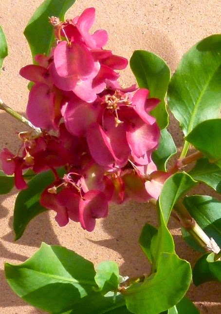
Some of the desert flowers are blossoming. I could provide photos of a dozen more, but this is a good sample.


Interesting formations.


End of Horsethief Canyon. Look closely to the left of the BIG boulder near centre ... that's Tom & Peg providing scale to the scene.

Whiptail Lizard.

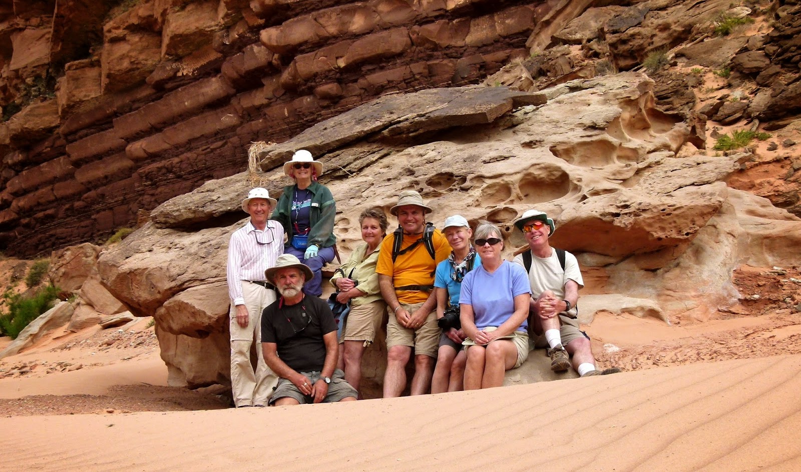
The Hikers
A good example of a changing campsite. We were here for 2 nights and the water level dropped about 1.5 feet. Paddlers on sites further up Horsethief Canyon packed out through the mud and dragged boats to find water to float. We were fortunate - loading was a little messy but we were able to float the loaded boats just across from our camp.


Fort Bottom was named after a tower-like structure that was built above the river bottom by the Anasazi Indians some 750 years ago. It isn’t clear what the tower was used for, but many such towers have been found throughout the Southwest. Often they are located on mesa tops with lines of sight between them, which suggests that they may have been used for signaling between Anasazi settlements.

The Cross of the Butte.


A Throned Buddha reigns above the river.

Hidden fresh water pool.

Paddling on the Colorado River.

LAST CAMP: View down the Colorado from our tent.

The jet boat shuttle picked up 3 other groups at Spanish Bottom a couple of miles further downstream on the Colorado. Once we're loaded it will be a 2 hour, 47 mile shuttle upstream to Potash Landing and then a 1/2 hr bus trip back to Moab. The loaded jet boat will be tractor-trailered back to Moab where we will unpack it and load onto private vehicles.


Crusty ... reporting!

No comments:
Post a Comment
Your comments, suggestions, observations and even opinions are welcome ... please leave some!